
 The color map display is at the entrance to the Chancellorsville Battlefield Visitor Center, Stop One on the Auto Tour. The map shows the situation on May 2, 1863, the day of the most intense fighting of the battle, and also highlights some areas from May 1 and 3.
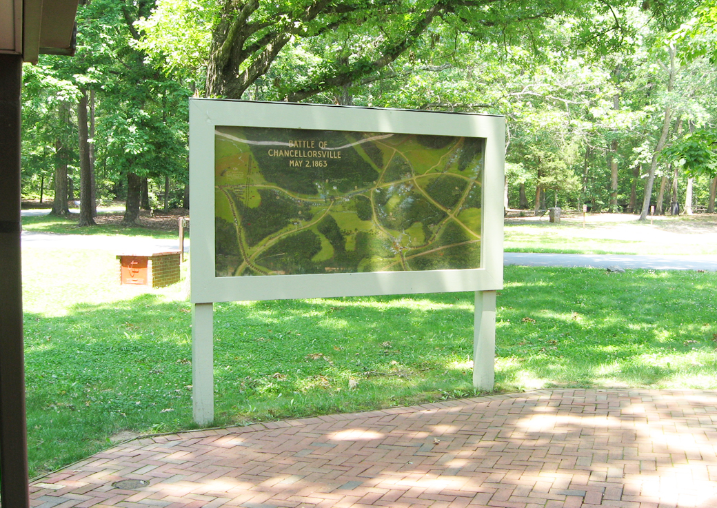
Text from the map:
Battle of Chancellorsville
May 2, 1863
1 – Jackson and Lee met here May 1.
2 – Jackson’s flank maneuver early morning May 2.
3 – Hooker convinced that Jackson was in retreat, met with some success here.
4 – Lee’s position May 2 thwarts Union left flank.
5 – Federal troops resting unaware of Jackson’s imminent attack and stampeded.
6 – Jackson halts here to make a reconnaissance.
7 – Jackson reconnoiters (Burton Farm).
8 – 6 p.m. Jackson drives forward, stampeding the Eleventh Corps. His wide line overlapping the Union’s desperate attempts to reform.
9 – 7 p.m. Here remnants of the Eleventh Corps make a last stand.
10 – Eleventh Corps Retreating.
11 – Jackson mortally wounded here.
12 – Hazel Grove. Confederate guns batter the Federals May 3.
13 – Federal troops retreating May 3.
14 – Hooker’s last defensive line May 3,4,5.

Location of the Map
The map is in front of the door to the Chancellorsville Visitor Center
(go to the main Stop 1 page)
(go to the main Chancellorsville Battlefield Auto Tour page)