
Harpers Ferry Main • Tour the Battlefield > S Schoolhouse Ridge
The Setting the Trap wayside marker is southwest of Harpers Ferry on South Schoolhouse Ridge in Harpers Ferry National Historical Park. 
Looking northeast from the crest of South Schoolhouse Ridge to the parking area for the Millville Road trailhead about 430 yards distant. The tall ridge in the distance on the left is Maryland Heights on the north side of the Potomac a little over three miles distant. A.P. Hill’s Confederate troops on this part of the ridge pivoted north and east to outflank the Union defensive lines from the south, setting up artillery on the Chambers (now Murphy) farm.From the marker:
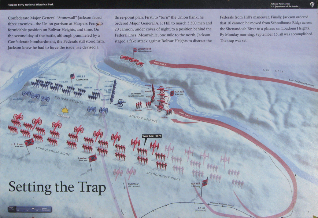
Setting the Trap
Confederate Major General “Stonewall” Jackson faced three enemies – the Union Garrison at HarpersFerry, its formidable positiion on Bolivar Heights, and time. On the second day of the battle, although pummeled by a confederate bombardment, the Federals stood firm. Jackson knew he had to force the issue. He devised a three-point plan. First, to “turn” the Union flank, he ordered Major General A.P. Hill to march 3,500 men and 20 cannon, under cover of night, to a position behind the Federal lines. Meanwhile, one mile to the north, Jackson staged a fake attack against Bolivar Heights to distract the Federals from Hill’s maneuver. Finally, Jackson ordered that 10 cannon be moved from Schoolhouse Ridge across the Shenandoah River to a plateau on Loudon Heights. By Monday morning, September 15, all was accomplished. The trap was set.
Location of the Setting the Trap wayside marker
The marker is about 430 yards from the parking area on the South Schoolhouse Ridge trail. The trailhead is southwest of Harpers Ferry on the west side of Millville Road about 0.7 mile south of U.S. 340. (39°18’24.7″N 77°46’54.7″W)