
Five Forks • Tour the Battlefield • The Armies • Battle Maps
– – –
Visitor Center • Stop 1 • Stop 2 • Stop 3 • Stop 4 • Stop 5
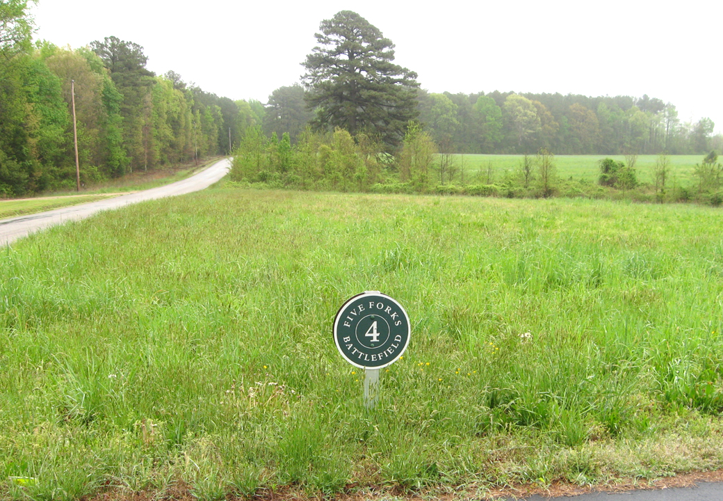
 Stop Four on the Five Forks Battlefield Auto Tour is ‘The Final Stand.’ It is on the north side of White Oak Road about 1 mile west of the Five Forks Intersection. (see map and directions below)
As the crushing Union flank attack moved across the field from the east, the west side of the field became the only escape route for most Confederates.
‘A Final Stand’ wayside marker
The ‘A Final Stand’ wayside marker is at Stop Four. It tells the story of the last stages of the battle as the Confederates fought rear guard actions to allow the rest of the army to escape.
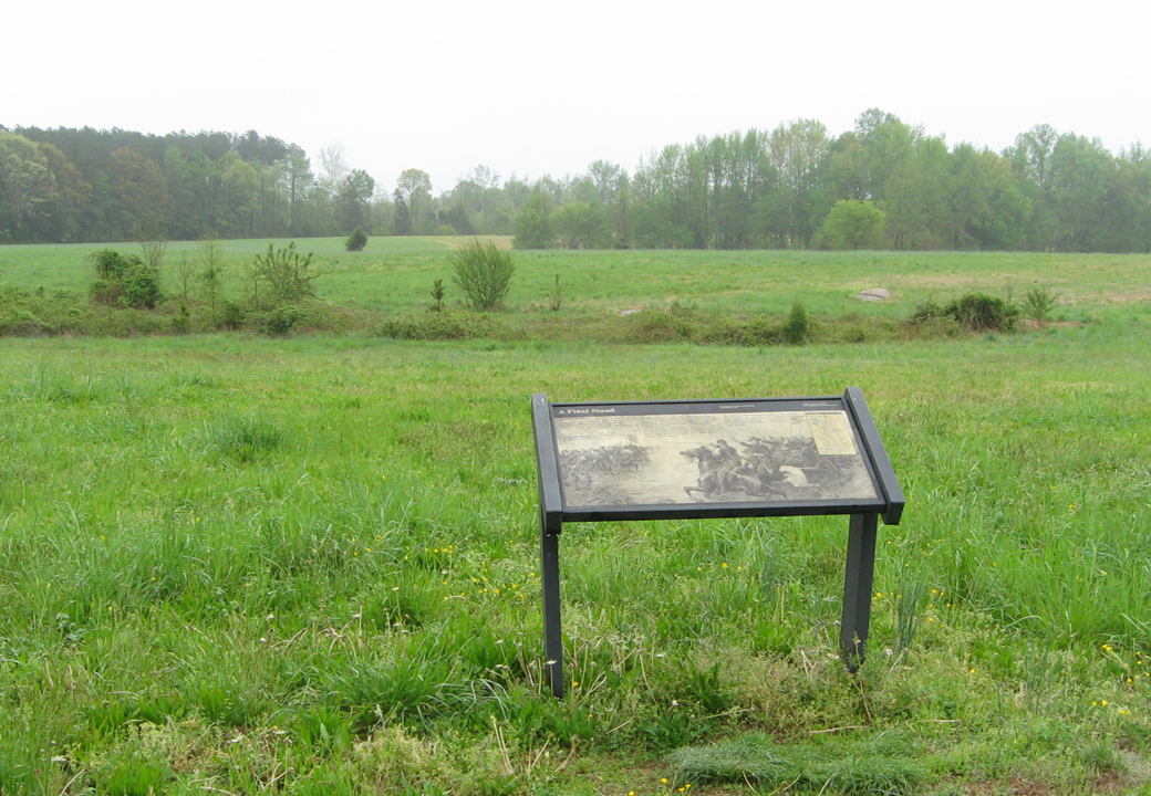
The “A Final Stand” wayside marker looking out over fields little changed from the Civil War
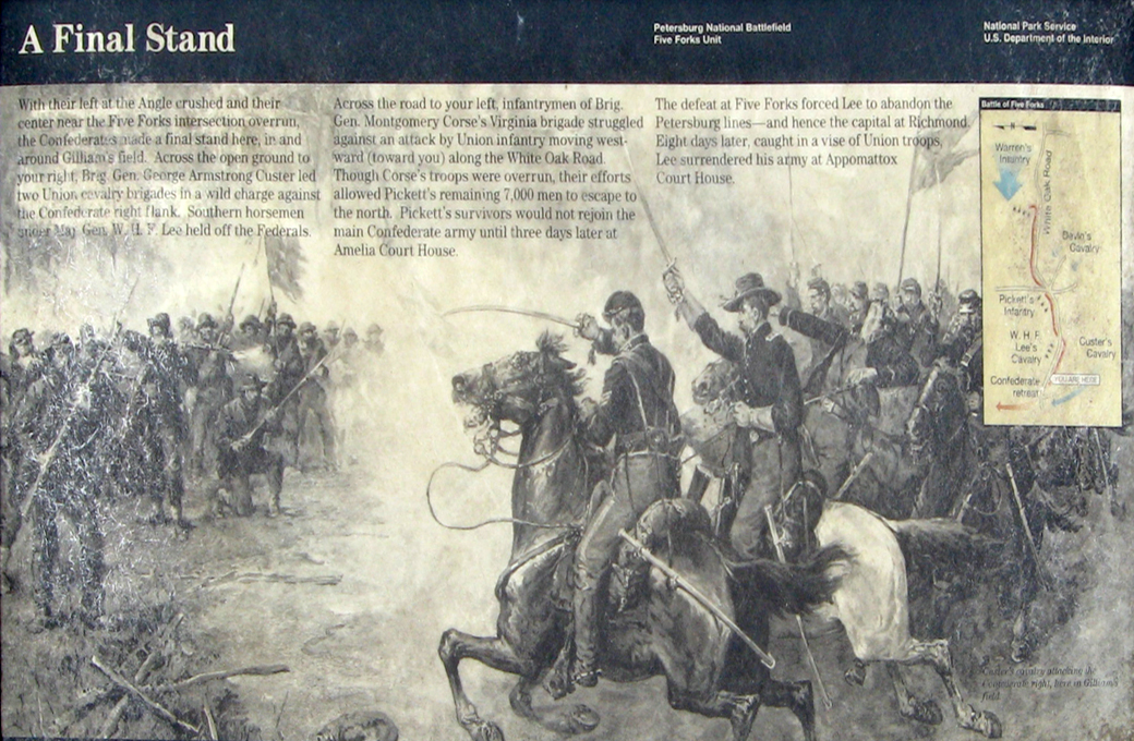
Closeup of the “A Final Stand wayside marker”
From the marker:
A Final Stand
With their left at the Angle crashed and their center near the Five Forks intersection overrun, the Confederates made a final stand here, in and around Gilliam’s field. Across the open ground to your right, Brig. Gen. George Armstrong Custer led two Union cavalry brigades in a wild charge against the Confederate right flank. Southern horsemen under Maj. Gen. W.H.F. Lee held off the Federals.
Across the road to your left, infantrymen of Brig. Gen. Montgomery Corse’s Virginia brigade struggled against an attack by Union infantry moving westward (toward you) along the White Oak Road. Though Corse’s troops were overrun, their efforts allowed Pickett’s remaining 7,000 men to escape to the north. Pickett’s survivors would not rejoin the main Confederate army until three days later at Amelia Court House.
The defeat at Five Forks forced Lee to abandon the Petersburg lines – and hence the capital at Richmond. Eight days later, caught in a vise pf Union troops, Lee surrendered his army at Appomattox Court House.
From the caption to the background drawing:
Custer’s cavalry attacking the Confederate right, here at Gilliam’s field.
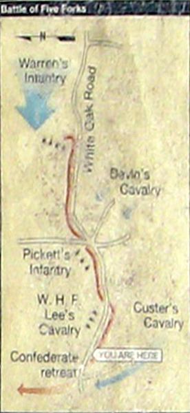
(below) Inset map from the marker showing the troop positions at the Battle of Five Forks. Picket’s Confederate Infantry Division defended a line along White Oak Road with W.H.F. Lee’s Cavalry Division on the western flank strengthened by guns from Dearing’s Artillery Battalion at three positions.
Devin’s and Custer’s Union Cavalry Divisions pinned the Confederates with attacks along the line while Custer launched a flanking attack against Lee’s Cavalry and three infantry divisions of Warren’s Fifth Corps attacked on the eastern flank.
Map and directions to Stop 4
Stop Four on the Five Forks Auto Tour is on the north side of White Oak Road about 1 mile west of the Five Forks Intersection. (37°08’24.0″N 77°38’20.4″W)
 Directions to the next stop on the Auto Tour:
Turn right out of the parking area onto White Oak Road and return the 1 mile to the Five Forks intersection. Turn left (north) on Courthouse Road 0.5 mile. The parking area for Stop Five is on the right.