
Winchester > Second Battle of Winchester
The Second Battle of Winchester – Louisiana Tigers Capture West Fort wayside marker is on the northwest side of Winchester (see map below). It shows the movement of Confederate General Jubal Early in his march to outflank Union General Robert Milroy at the beginning of the June, 1863 Gettysburg Campaign.
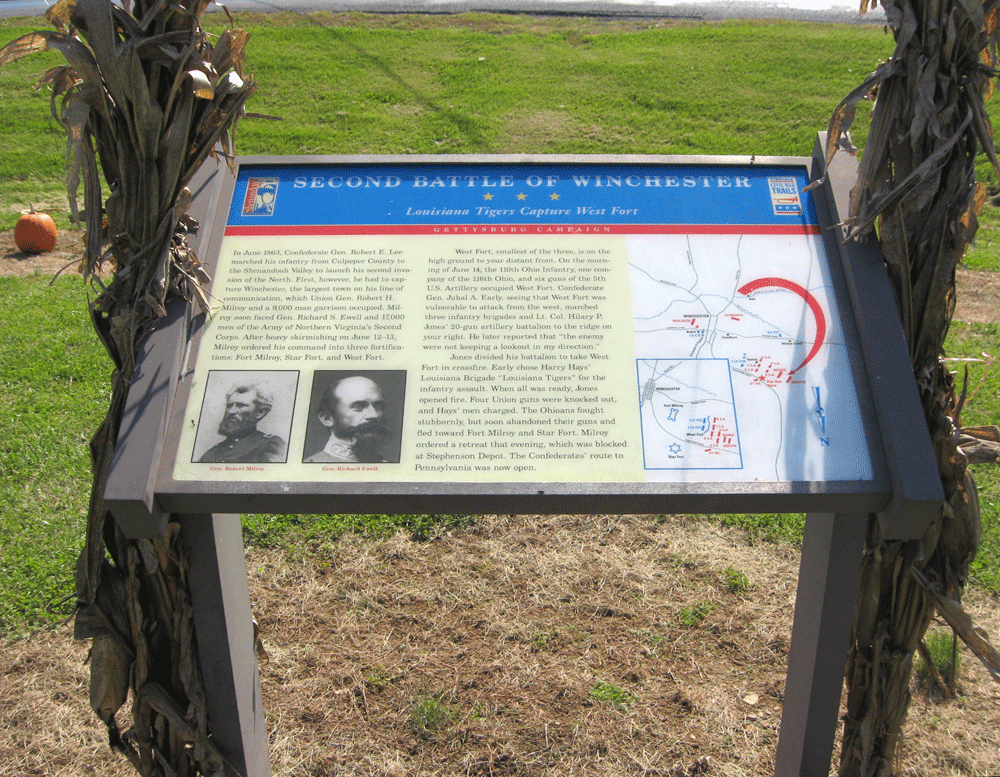
From the marker:
Second Battle of Winchester
Louisiana Tigers Capture West Fort
In June 1863, Confederate Gen. Robert E. Lee marched his infantry from Culpeper County to the Shenandoah Valley to launch his second invasion of the North. First, however, he had to capture Winchester, the largest town on his line of communication, which Union Gen. Robert H. Milroy and a 9,000 man garrison occupied. Milroy soon faced Gen. Robert S. Ewell and 17,000 men of the Army of Northern Virginia’s Second Corps. After heavy skirmishing on June 12-13, Milroy ordered his command into three fortifications: Fort Milroy, Star Fort, and West Fort.
West Fort, smallest of the three, is on the high ground to your distant front. On the morning of June 14, the 110th Ohio Infantry, one company of the 116th Ohio, and six guns of the 5th U.S. Artillery occupied West Fort. Confederate Gen. Jubal A. Early, seeing that West Fort was vulnerable to attack from the west, marched three infantry brigades and Lt. Col. Hilary P. Jones’ 20-gun artillery battalion to the ridge on your right. He later reported that “the enemy were not keeping a lookout in my direction.”
Jones divided his battalion to take West Fort in crossfire. Early chose Harry Hays’ Louisiana Brigade “Louisiana Tigers” for the infantry assault. When all was ready, Jones opened fire. Four Union guns were knocked out, and Hays’ men charged. The Ohioans fought stubbornly, but soon abandoned their guns and fled toward Fort Milroy and Star Fort. Milroy ordered a retreat that evening, which was blocked at Stephenson Depot. The Confederates’ route to Pennsylvania was now open.
Location
The marker is nothwestwest of Winchester, Virginia on North Frederick Pike (U.S. 522) at the intersection with Indian Hollow Road next to the parking lot of the Virginia Farm Market. (39°12’53.9″N 78°11’29.8″W)