
The High Bridge across the Appomattox River Valley outside Farmville, Virginia was one of the largest rail bridges in the world at the time of the Civil War. It carried the South Side Railroad, a vital supply route for Richmond and Petersburg, particularly in the closing months of the war. During Lee’s Retreat to Appomattox it became the scene of two days of fighting as both sides tried to deny each other the use of the bridge.
Today you can walk, bike, or take your horse across the successor to the Civil War era bridge, viewing the original brick bridge piers next to the current structure. It is part of the High Bridge Trail State Park.
Identical wayside markers on both sides of the bridge give a brief story of the bridge.
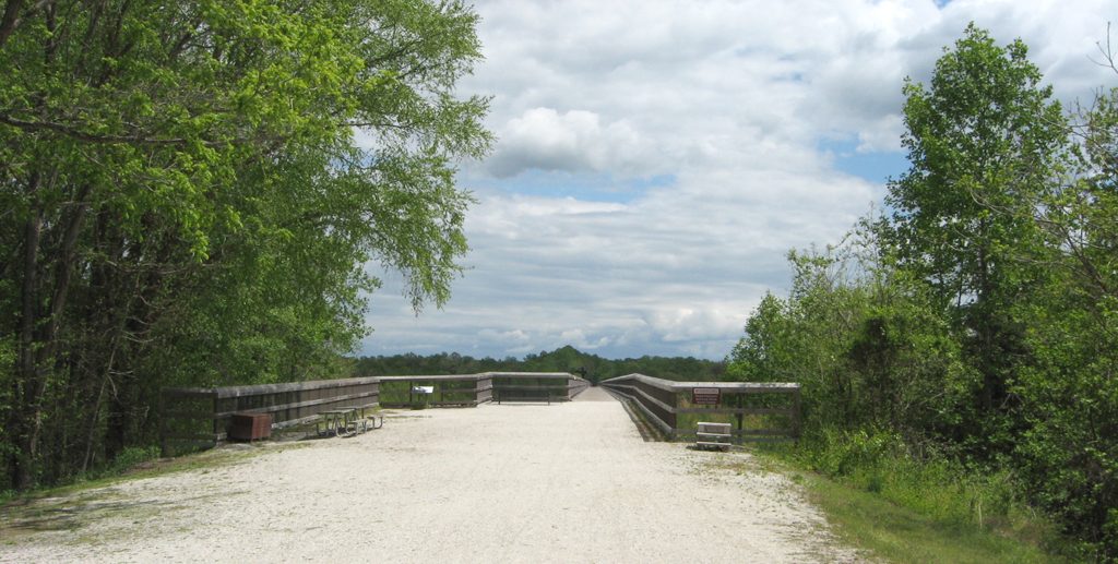
West end of the High Bridge over the Appomattox River with bench and wayside marker
Looking east at the High Bridge from its west end. You can see the covered bench partway across the bridge.
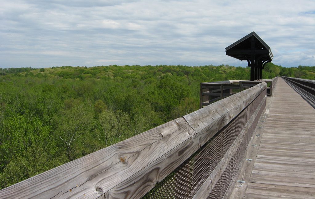
The view from the middle of the bridge along with the covered bech.
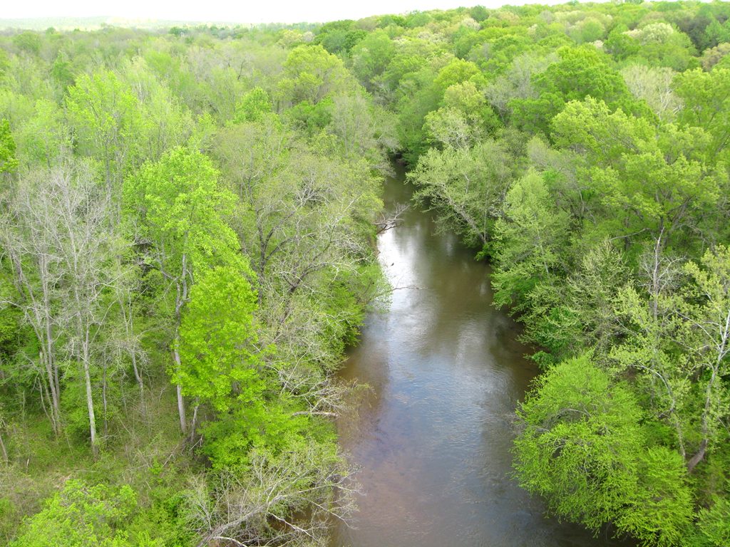
The Appomattox River from the middle of the High Bridge. At the time of the Civil War a road bridge also crossed here at river level.
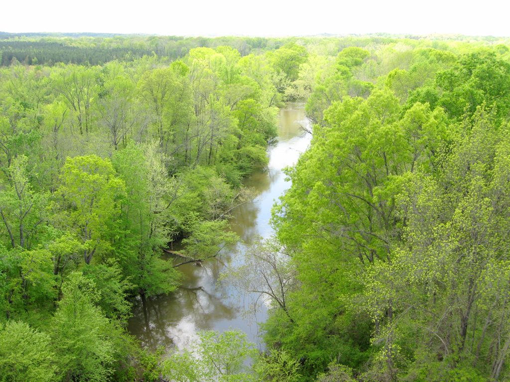
The Appomattox River from the middle of the High Bridge. The bridge here is 160 feet above the river.
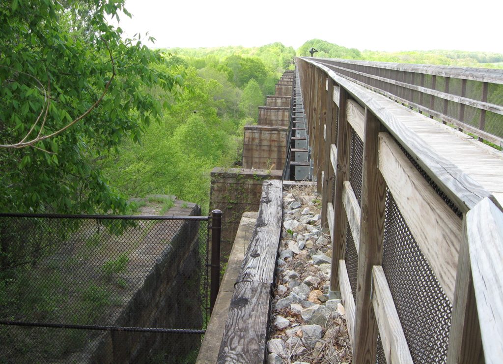
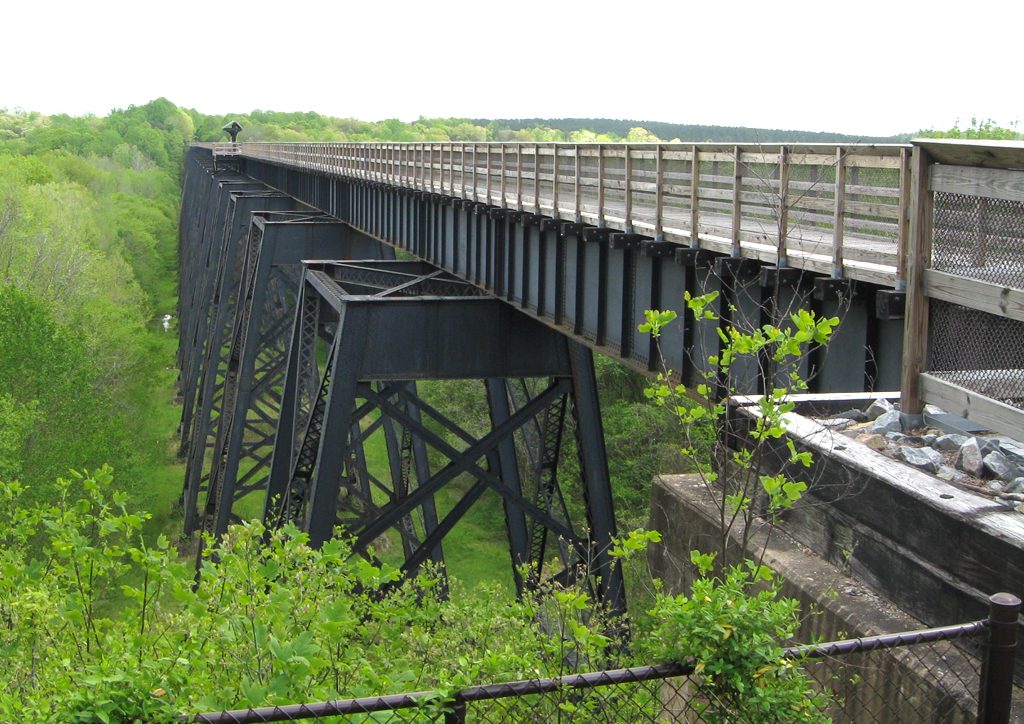
Looking west from the east end of the bridge. The original brick piers can be seen just below and to the left of the current steel piers.
Location
The High Bridge crosses the Appomattox River valley six miles downstream (northeast) of Farmville. It can be reached by the High Bridge hiking/biking/horse trail from either side. From the west side take the River Road (Route 600) northeast from Farmville. About three miles from town there is a parking area on the north side of River Road. It is administered by Virginia state parks and requires a modest parking fee. From there a level trail of about a mile leads southeast to the bridge. Be careful – the trail goes both ways. I spoke with a hiker who went a couple of miles in the wrong direction before she turned around and made it to the bridge. There are benches along the way and at the bridge to take a break.