
Battles of Manassas • Tour the Battlefield • Monuments • The Armies
The Brownsville Picnic Area Orientation marker is in the southwest part of the park at the Brownsville Picnic Area off Groveton Road (see map below).
Text from the right panel of the marker:
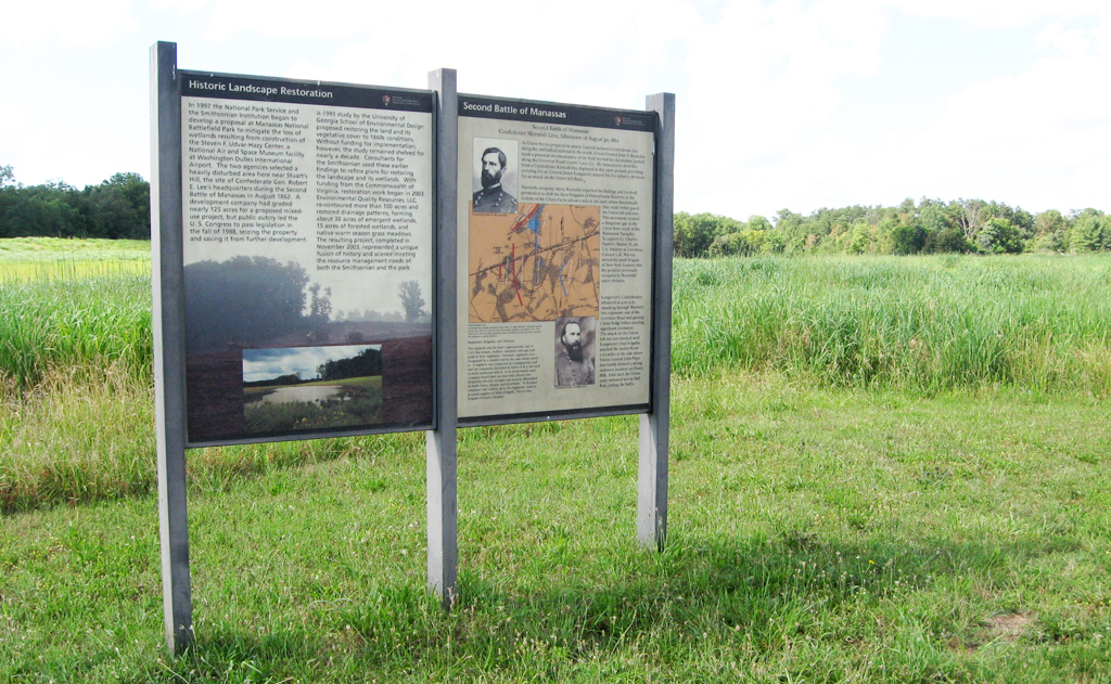
Second Battle of Manassas
Confederate Skirmish Line, Afternoon of August 30, 1862
Narrowly escaping injury, Reynolds reported his findings and received permission to shift his three brigades of Pennsylvania Reserves to the vicinity of the Chinn Farm (about a mile to the east) where theoretically they could better guard the Union left and rear. This movement created a dangerous gap in the Union lines south of the Warrenton Turnpike. To support Lt. Chrles Hazlett’s Battery D, 5th U.S. Artillery at Groveton, Colonel G. K. Warren moved his small brigade of New York Zouaves into the position previously occupied by Reynolds’ entire division.
Longstreet’s Confederates advanced at 4:00 p.m. smashing through Warren’s two regiments east of the Groveton Road and gaining Chinn Ridge before meeting significant resistance. The attack on the Union left was not checked until Longstreet’s lead brigades reached the Sudley Road 1-1/2 miles to the east where Union General John Pope had hastily formed a strong defensive position on Henry Hill. After dark the Union army retreated across Bull Run, ending the battle.
Regiments, Brigades, and Division
The regiment was the basic organizational unit of Civil War armies. Soldiers identified with and took pride in their regiments. Volunteer regiments were designated by a number and by the state which raised it. A regiment was composed of a headquarters staff and ten companies identified by letters A-K (J not used to avoid confusion with I). At its initial muster each company would have 100 men with officers, but frequently effective strength was severely diminished by battle losses, disease, and desertions. To facilitate command and control, up to five regiments could be grouped together to form a brigade. Two to four brigades formed a division.
Caption to the illustration at top left:
General John F. Reynolds
Caption to the illustration at bottom right:
General James Longstreet
Caption below the map:
A skirmish line usually consisted of two rifle or “light infantry” companies spread out in open order to cover the front of an entire regiment. Skirmishers were often deployed to feel out enemy positions, cover movements of the main body, and alert the regiment to enemy advances.

Text from the left panel of the marker:
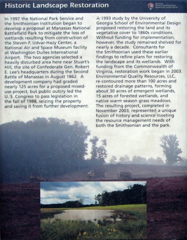
Historic Landscape Restoration
In 1997 the National Park Service and the Smithsonian Institution began to develop a proposal at Manassas National Battlefield Park to mitigate the loss of wetlands resulting from the construction of the Steven F. Udvar-Hazy Center, a National Air and Space Museum facility at Washington Dulles International Airport. The two agencies selected a heavily disturbed area here near Stuart’s Hill, the site of Confederate Gen. Robert E. Lee’s headquarters during the Second Battle of Manassas in August 1862. A development company had graded nearly 125 acres for a proposed mixed-use project, but public outcry led the U.S. Congress to pass legislation in the fall of 1988, seizing the property and saving it from further development.
A 1993 study by the University of Georgia School of Environmental Design proposed restoring the land and its vegetative cover to 1860s conditions. Without funding for implementation, however, the study remained shelved for nearly a decade. Consultants for the Smithsonian used these earlier findings to refine plans for restoring the landscape and its wetlands. With funding from the Commonwealth of Virginia, restoration work began in 2003. Environmental Quality Resources, LLC, re-contoured more than 100 acres and restored drainage patters, forming about 30 acres of emergent wetlands, 15 acres of forested wetlands, and native warm season grass meadows. The resultant project, completed in November 2003, represented a unique fusion of history and science meeting the resource management needs of both the Smithsonian and the park.
Location of the Brownsville Picnic Area Orientation marker
The marker is on the north side of the parking area in the Brownsville picnic area off Groveton Road.