
Battle of South Mountain • Turner’s Gap • Fox’s Gap • Crampton’s Gap
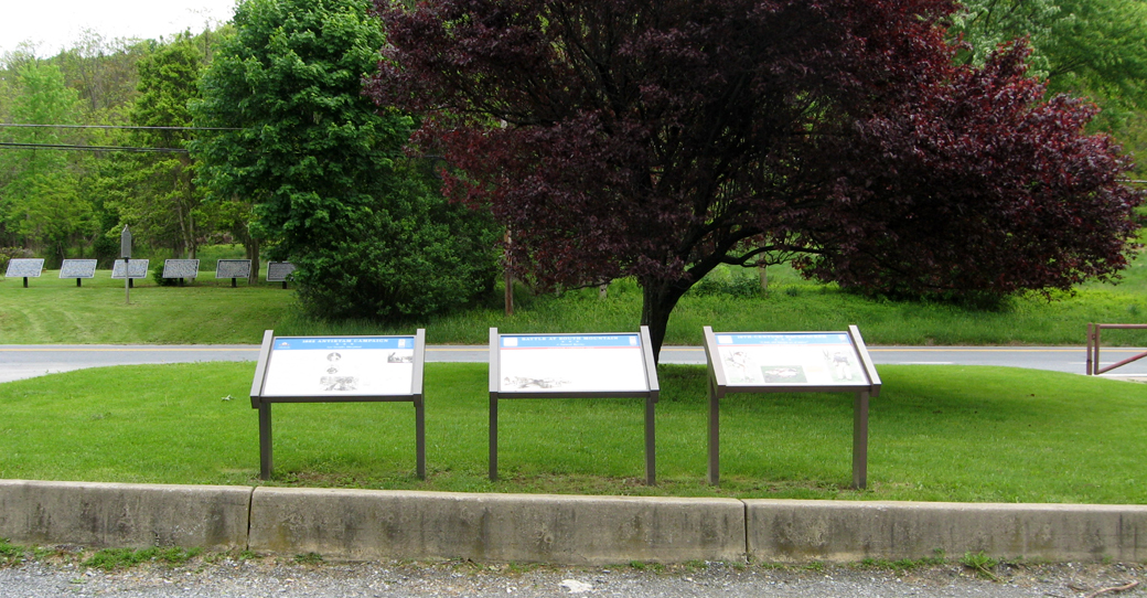
There are three wayside markers next to the parking lot of the Old South Mountain Inn on the south side of Alternate U.S. Route 40 at the summit of South Mountain.
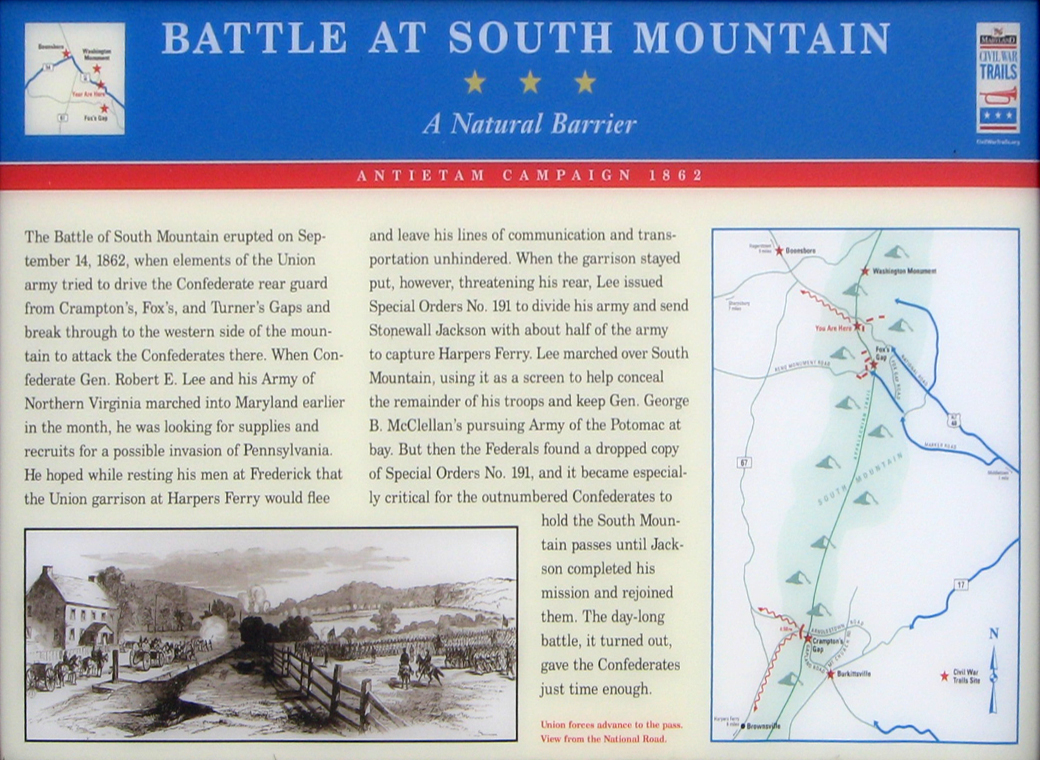
Battle at South Mountain wayside marker
Text from the marker:
Battle at South Mountain
A Natural Barrier
Antietam Campaign 1862
The Battle of South Mountain erupted on September 14, 1862 when elements of the Union army tried to drive the Confederate rear guard from Crampton’s, Fox’s, and Turner’s Gaps and break through to the western side of the mountain to attack the Confederates there. When Confederate Gen. Robert E. Lee and his Army of Northern Virginia marched into Maryland earlier in the month, he was looking for supplies and recruits for a possible invasion of Pennsylvania. He hoped while resting his men at Frederick that the Union garrison at Harpers ferry would flee and leave his lines of communication and transportation unhindered. When the garrison stayed out, however, threatening his rear, Lee issued Special Orders No. 191 to divide his army and send Stonewall Jackson with about half of the army to capture Harpers Ferry. Lee marched over South Mountain, using it as a screen to help conceal the remainder of his troops and keep Gen. George B. McClellan’s pursuing Army of the Potomac at bay. But then the Federals found a dropped copy of Special Orders No. 191, and it became especially critical for the outnumbered Confederates to hold the South Mountain passes until Jackson completed his mission and rejoined them. The day long battle, it turned out, gave the Confederates just time enough.
From the caption to the drawing on the bottom left:
Union forces advance to the pass. View from the National Road.
1862 Antietam Campaign wayside marker
Text from the marker:
1862 Antietam Campaign
Lee Invades Maryland
Fresh from victory at the Second Battle of Manassas, Gen. Robert E. Lee’s Army of Northern Virginia crossed the Potomac River on September 4-6, 1862, to bring the Civil War to Northern soil and to recruit sympathetic Marylanders. Union Gen. George B. McClellan’s Army of the Potomac pursued Lee, who had detached Gen. Thomas J. “Stonewall” Jackson’s force to capture the Union garrison at Harpers Ferry. After the Federals pushed the remaining Confederates out of the South Mountain gaps, Lee awaited Jackson’s return near Sharpsburg and Antietam creek
On September 17, at the Battle of Antietam, the two armies clashed in the single bloodiest day in American history and suffered some 23,000 casualties. Lee soon retreated across the Potomac, ending his first invasion of the north.
Follow in the footsteps of Gens. Lee and McClellan along Maryland Civil War Trails’ Antietam Campaign: Lee Invades Maryland, a 90 mile tour route that allows you to explore the stories of triumph and tragedy at more than 60 Civil War sites. Please travel carefully as you enjoy the beauty and history along the trail.
From the caption to the inset photo on the right:
The Confederate Army crosses the Potomac River into Maryland
From the caption to the inset photo on the bottom:
Franklin’s Corps storming Crampton’s Gap on South Mountain

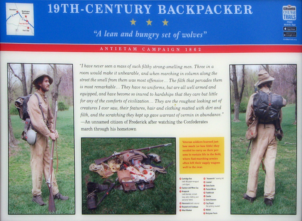
19th Century Backpacker wayside marker
Text from the marker:
19th-Centure Backpacker
“A lean and hungry set of wolves”
Antietam Campaign 1862
“I have never seen a mass of such filthy strong-smelling men. Three in a room would make it unbearable, and when marching in column along the street the smell from them was most offensive… The filth that pervades them is most remarkable… They have no uniforms, but are all well armed and equipped, and have become so inured to hardships that they care but little for any of the comforts of civilization… They are the roughest looking set of creatures I ever saw, their features, hair and clothing matted with dirt and filth, and the scratching they kept up gave warrant of vermin in abundance.”
-an unnamed citizen of Frederick after watching the Confederates march through his hometown
From the text in the yellow box:
Veteran soldiers learned just how much (or how little) they needed to carry on their persons to sustain life in the field, where fast-marching armies often left their supply wagons well to the rear.
A Cartridge box (with 40 paper wrapped cartridges)
B Canteen and mess cup
C Knapsack (with blanket, oilcloth tarp, extra clothing and personal items)
D Haversack with rations
E Bayonet with Scabbard
F Wool blanket
G “Housewife” (sewing kit)
H Journal
I Extra socks
J Pocket mirror
K Toothbrush
L Candle
M Extra drawers
N Cap pouch (for priming musket)
O Wallet
P Religious tracts
Location of the Turner’s Gap wayside marker trio
The Turner’s Gap wayside marker trio is on the south side of Alternate U.S. Route 40 at the summit of South Mountain next to the parking lot at the former Old South Mountain Inn. (39° 29.082′ N, 77° 37.176′ W)