
Battle of Chancellorsville • Tour the Battlefield • Monuments & Markers • The Armies
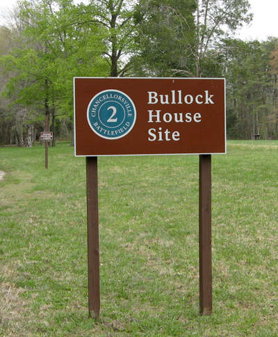
 The Bullock House Site is Stop 2 on the Chancellorsville Battlefield Auto Tour. (see map at bottom)
After Hooker was driven back from his position at Chancellorsville House on May 3 he consolidated his lines around his lifeline across the Rapahannock at U.S. Ford. The southernmost angle of his line was here at the intersection of Mineral Spring Road (a continuation of Bullock Road no longer in use today) and Ely’s Ford Road. The Bullock family farm on the south side of the intersection was devastated during the battle, like most civilian property in the area.
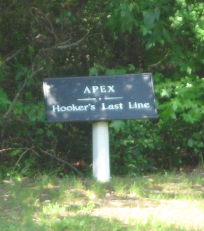
A marker for the “Apex of Hooker’s Last line” is across the intersection from the Hooker’s Final Bastion and Union Lifeline markers. This was the southernmost tip of Hooker’s final defensive line around United States Ford before he retreated north of the river.
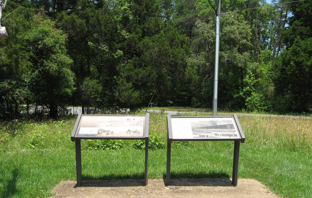
 There are three wayside markers at this stop: Hooker’s Final Bastion, Union Lifeline, and Lives Transformed. All are shown below.
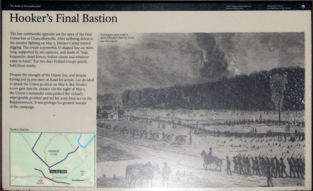
Hooker’s Final Bastion wayside marker
The “Hooker’s Final Bastion” wayside marker is next to the “Union Lifeline” wayside marker.
Looking northeast past the markers toward Ely’s Ford Road. The “Apex” marker can be seen across the road above the left edge of the right marker
Text from the marker:
Hooker’s Final Bastion
The low earthworks opposite are the apex of the final Union line at Chancellorsville. After suffering defeat in the massive fighting on May 3, Hooker’s army started digging. The result: a powerful, U-shaped line six miles long supported by 100 cannons, and made of “logs, knapsacks, dead horses, limber-chests and whatever came to hand.” For two days Federal troops quietly held these works.
Despite the strength of the Union line, and despite having just 35,000 men on hand for action, Lee decided to attack the Union position on May 6. But Hooker never gave him the chance. On the night of May 5, the Union commander relinquished the virtually impregnable position and led his army back across the Rappahannock. It was perhaps his greatest mistake of the campaign.
From the caption to the drawing:
Union guns stand ready to defend Hooker’s final line in this war-time sketch.
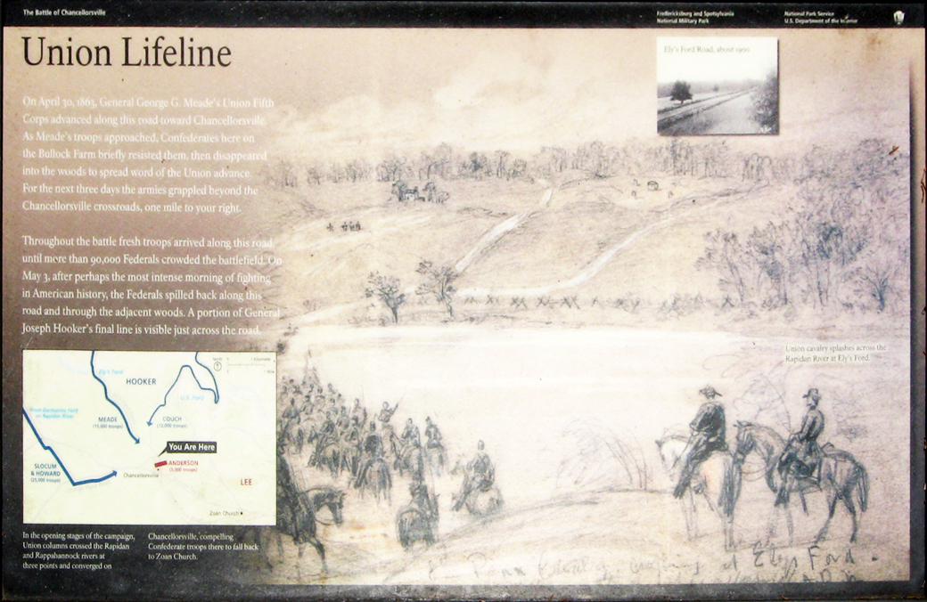
Union Lifeline wayside marker
Text from the marker:
Union Lifeline
On April 30, 1863, Gen. George G. Meade’s Union Fifth Corps advanced along this road toward Chancellorsville. As Meade’s troops approached, Confederates on the Bullock Farm briefly resisted them, then disappeared into the woods to spread word of the Union advance. For the next three days the armies would grapple beyond the Chancellorsville crossroads, one mile to your right.
Throughout the battle fresh troops arrived along this road, until more than 90,000 Federals crowded the battlefield. On May 3, after perhaps the most intense morning of fighting in American history, the Federals spilled back along this road and through the adjacent woods. A portion of General Joseph Hooker’s final line is visible across the road.
From the caption to the drawing:
Union cavalry splashes across the Rapidan River at Ely’s Ford.
From the caption to the inset photot at upper right:
Ely’s Ford, about 1900.
From the caption to the map:
In the opening stages of the campaign, Union columns crossed the Rapidan and Rappahannock Rivers at three points and converged on Chancellorsville, compelling Confederate troops there to fall back to Zoan Church.
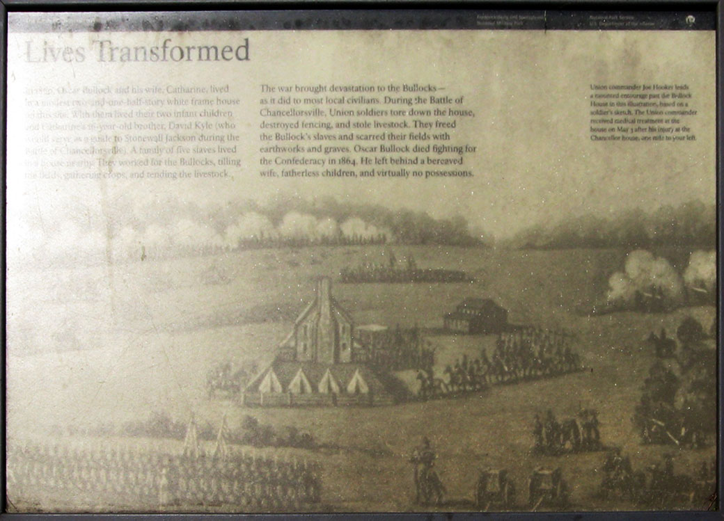
Lives Transformed wayside marker
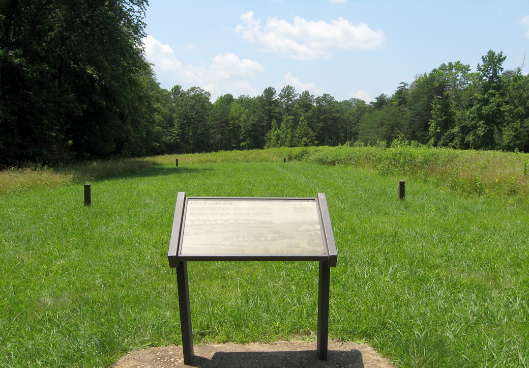
Looking past the Lives Transformed wayside marker to the site of the Bullock House, marked by the wooden posts
Text from the marker:
Lives Transformed
In 1860, Oscar Bullock and his wife, Catharine, lived in a modest two-and-one-half-story white frame house on this site. With them lived their two infant children and Catharine’s 16-year-old brother, David Kyle (who would serve as a guide to Stonewall Jackson during the Battle of Chancellorsville). A family of five slaves lived in a house nearby. They worked for the Bullocks, tilling the fields, gathering crops, and tending the livestock.
The war brought devastation to the Bullocks – as it did most local civilians. During the Battle of Chancellorsville, Union soldiers tore down the house, destroying fencing, and stole livestock. They freed the Bullock’s slaves and scarred their fields with earthworks and graves. Oscar Bullock died fighting for the Confederacy in 1864. He left behind a bereaved wife, fatherless children, and virtually no possessions.
From the caption to the photo:
Union commander Joe Hooker leads a mounted entourage past the Bullock House in this illustration, based on a soldier’s sketch. The Union commander received medical treatment at the house on May 3 after his injury at the Chancellor house, one mile to your left.
Map and directions to Stop 2
Stop 2 on the Chancellorsville Battlefield Auto Tour is on the east side of Bullock Road just before it ends at Ely’s Ford Road 0.75 mile north of the Visitor Center. (38°19’01.8″N 77°38’18.2″W)
 Directions to the next stop on the Auto Tour:
Bullock Road ends at Ely’s Ford Road. Turn right. Stop 3 is about 0.7 mile on the right.