
The ‘A Position Strong by Nature’ wayside marker is on the west side of Harpers Ferry in the valley between Bolivar Heights and North Schoolhouse Ridge. It is beside the parking area on the east side of Bakerton Road (County Route 27) on the Union Skirmish Line Trail. It is next to the First Line of Defence: Union Skirmish Line marker.

The marker looks up at the Union defensive positions on Bolivar Heights
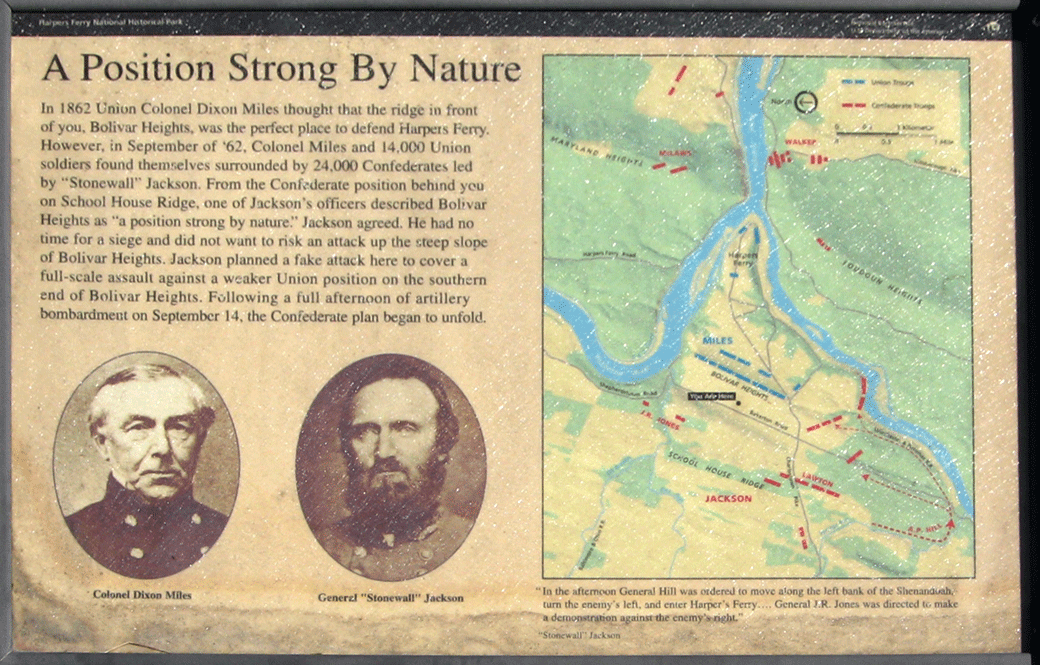
Text from the marker:
A Position Strong by Nature
In 1862 Union Colonel Dixon Miles thought that the ridge in front of you, Bolivar Heights, was the perfect place to defend Harpers Ferry. However, in September of ’62, Colonel Miles and 14,000 Union soldiers found themselves surrounded by 24,000 Confederates led by “Stonewall” Jackson. From the Confederate position behind you on School House Ridge, one of Jackson’s officers described Bolivar Heights as “a position strong by nature.” Jackson agreed. He had no time for a siege and did not want to risk an attack up the steep slope of Bolivar Heights. Jackson planned a fake attack here on the southern end of Bolivar Heights. Following a full afternoon of artillery bombardment on September 14, the Confederate plan began to unfold.
“In the afternoon, General Hill was ordered to move along the left bank of the Shenandoah, turn the enemy’s left, and enter Harper’s Ferry….General J.R. Jones was directed to make a demonstration against the enemy’s right.”
“Stonewall” Jackson
Map to the “Position Strong By Nature” and “The First Line of Defense” markers
The markers are west of Harpers Ferry just south of the Union Skirmish Line Trail parking lot on the east side of Bakerton Road. (39°19’22.2″N 77°45’59.5″W)
(go to the main Union Skimish Line page)
go to the main Tour the Harpers Ferry Battlefield page)