
Harpers Ferry Main • Tour the Battlefield > Union Skirmish Line • Timeline
The Union Skirmish Line historical marker is west of Harpers Ferry in the valley between Schoolhouse Ridge and Bolivar Heights. It was sponsored by the Harpers Ferry Civil War Round Table and the American Civil War Round Table of the United Kingdom and erected by the Division of West Virginia Archives and History in 2001.
The marker is on the east side of Bakerton Road about 0.75 mile north of U.S. 340, just across the road from the parking area for the walking trails.
Text from the marker:
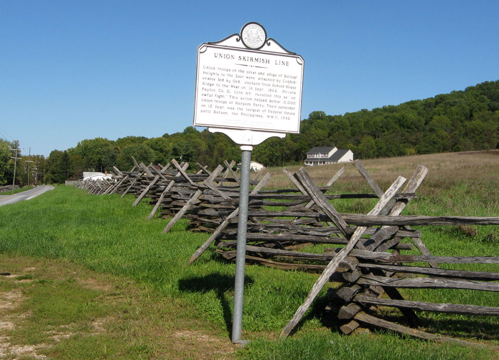
Union Skirmish Line
Union troops on the crest and slope of Bolivar
Heights to the East were attacked by Confederates
lead by Gen. Jackson from School House
Ridge to the West on 14 Sept. 1862. Private
Paylor, Co. D., 111th NY, recalled this as “an
awful fight.” This action helped defeat 12,000
Union troops at Harpers Ferry. Their surrender
on 15 Sept. was the largest of Federal forces
until Bataan, the Philippines, WW II, 1942.
Harpers Ferry CWRT, American CWRT (UK)
Division of West Virginia Archives and History 2001
Location of the marker
The Union Skirmish Line historical marker is west of Harpers Ferry on the east side of Bakerton Road across the road from the parking area for the trailhead for the Union Skrimish Line Trail and North Schoolhouse Ridge Trail. (39°19’31.0″N 77°45’59.1″W)
(go to the main Union Skimish Line page)
go to the main Tour the Harpers Ferry Battlefield page)