
Battle of Fredericksburg • Tour the Battlefield • Monuments & Markers • Armies
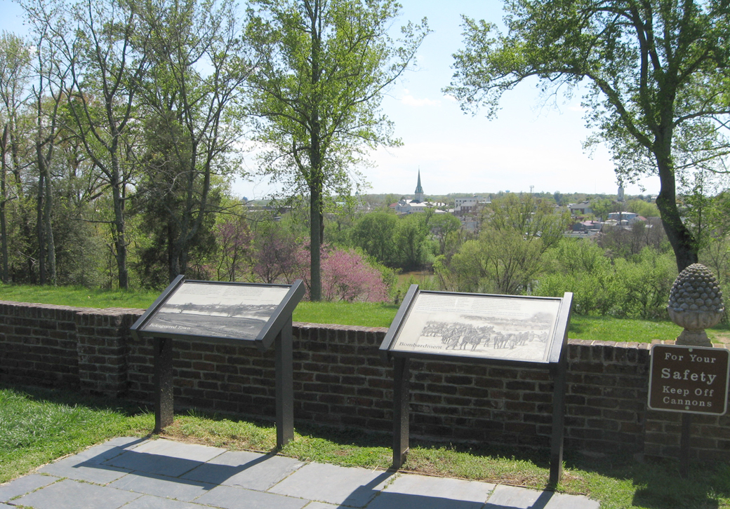
 The “Beleaguered Town” and Bombardment” wayside markers are at Chatham Manor, Stop Two on the Fredericksburg Battlefield Auto Tour. (see map below) The markers are on the terrace in front of the house (the side facing the river and town).
Beleaguered Town wayside marker
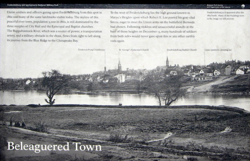
Beleaguered Town
Union soldiers and officers gazing upon Fredericksburg from this spot in 1862 saw many of the same landmarks visible today. The skyline of this peaceful river town, population 5,000 in 1860, is still dominated by the three steeples of City Hall and the Episcopal and Baptist churches. The Rappahannock River, which was a source of power, a transportation artery, and a military obstacle in the 1800s, flows from right to left along its journey from the Blue Ridge to the Chesapeake Bay.
To the west of Fredericksburg lies the high ground known as Marye’s Heights upon which Robert E. Lee posted his gray-clad forces, eager to meet the Union army on the battlefield Burnside had chosen. Following reckless and unsuccessful assaults at the base of those heights on December 13, many hundreds of soldiers from both sides would never gaze upon this or any other earthly vista again.
From the caption to the background photo:
Fredericksburg as it appeared after the 1862 battle. Many of the buildings seen in the image are still present.
From the call-outs on the map, from left to right:
Fredericksburg Courthouse
St. George’s Episcopal Church
Fredericksburg Baptist Church
Upper pontoon crossing site
Bombardment wayside marker
Text from the marker:
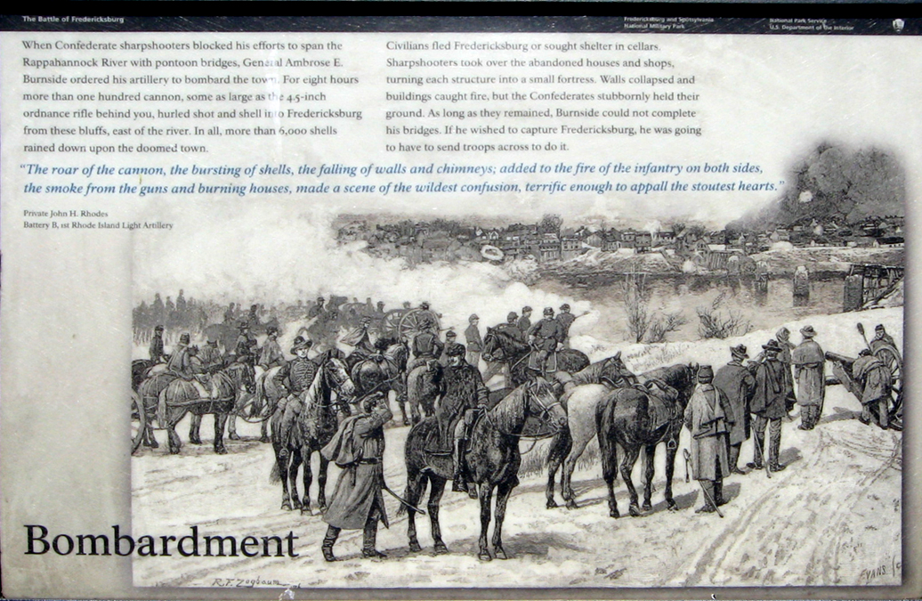
Bombardment
When Confederate sharpshooters blocked his efforts to span the Rappahannock River with pontoon bridges, General Ambrose E. Burnside ordered his artillery to bombard the town. For eight hours more than one hundred cannon, some as large as the 4.5-inch ordnance rifle behind you, hurled shot and shell into Fredericksburg from these bluffs, east of the river. In all, more than 6,000 shells rained down upon the doomed town.
Civilians fled Fredericksburg or sought shelter in cellars. Sharpshooters took over the abandoned houses and shops, turning each structure into a small fortress. Walls collapsed and buildings caught fire, but the Confederates stubbornly held their ground. As long as they remained, Burnside could not complete his bridges. If he wished to capture Fredericksburg, he was going to have to send troops across to do it.
“The roar of the cannon, the bursting of shells, the falling of walls and chimneys; added to the fire of the infantry on both sides, the smoke from the guns and burning houses, made a scene of the wildest confusion, terrific enough to appall the stoutest hearts.”
Private John H. Rhodes
Battery B, 1st Rode Island Artillery
Location of the markers
The markers are on the terrace in between the houseand the river about 150 feet from the manor, in between the two artillery pieces.