
Battle of Fredericksburg • Tour the Battlefield • Monuments & Markers • Facts • Armies
The E44 Battles of Fredericksburg Virginia historical marker is on Lafayette Boulevard a short distance south of Stop One on the Fredericksburg battlefield auto tour.
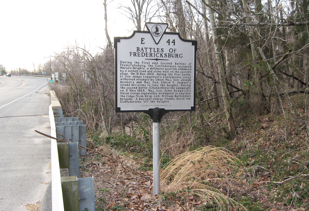
Text from the marker:
E44
Battles of Fredericksburg
During the First and Second Battles of
Fredericksburg, the Confederates occupied
Marye’s Heights, a defensive position enhanced
by a sunken road and stone wall on the eastern
slope. On 13 Dec. 1862, during the first battle,
Lt. Gen. James Longstreet’s Confederate corps
withstood attempts by Union Maj. Gen. Joseph
Hooker’s and Maj. Gen. Edwin V. Sumner’s
Grand Divisions to take the heights. During
the second battle (Chancellorsville campaign),
on 3 May 1863, Maj. Gen. John Sedgwick’s
Union troops repeatedly attempted to capture
the ridge from Brig. Gen. William Barksdale’s
brigade. A bayonet charge finally drove the
Confederates off the heights.
Department of Historic Resources 2000
Location of the marker
The marker is on the north side of on Lafayette Boulevard about .25 mile southwest of the Fredericksburg Battlerfield Visitor Center. There is a small space to pull off on the north side of the boulevard just before the bridge over Hazel Run and the intersection with the Blue and Grey Parkway (Virginia Route 3).