
3rd Winchester • Tour the Battlefield • Battle Maps • Battle Facts • The Armies
—
Red Bud Run • Star Fort • Fort Collier • Rutherford’s Farm
Stephenson Depot • National Cemetery • Confederate Cemetery
“The Confederates Reform” wayside marker is about a mile south of the Redbud Road trailhead on the walking tour on the Civil War Trust’s Third Winchester battlefield site. (see map below)
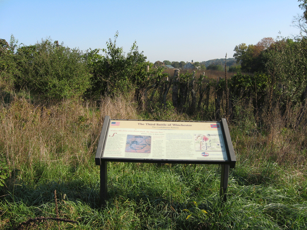
The maker looks north toward the Hackwood farmyard.
From the marker:
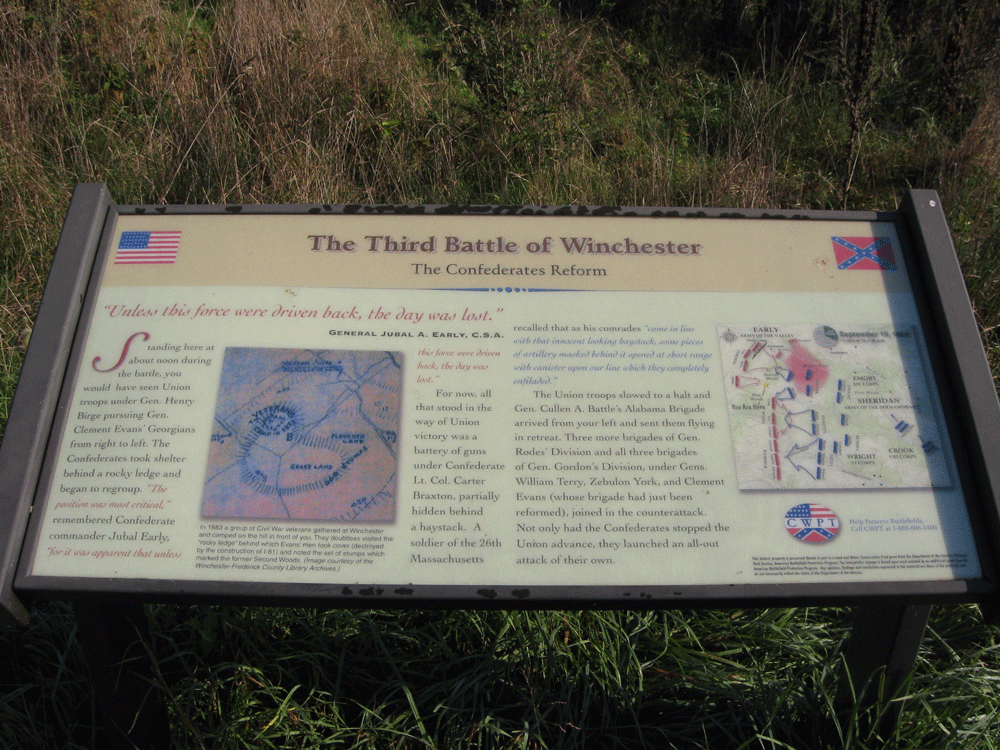
The Third Battle of Winchester
The Confederates Reform
“Unless this force were driven back, the day was lost.”
General Jubal A. Early, C.S.A.
Standing here about noon during the battle, you would have seen Union troops under Gen. Henry Birge pursuing Gen. Clement Evans’ Georgians from right to left. The Confederates took shelter behind a rocky ledge and began to regroup. “The position was most critical,” remembered Confederate commander Jubal Early, “for it was apparent that unless this force were driven back, the day was lost.”
For now, all that stood in the way of a Union victory was a battery of guns under Confederate Lt. Col. Carter Braxton, partially hidden behind a haystack. A soldier of the 26th Massachusetts recalled that as his comrades “came in line with that innocent looking haystack, some pieces of artillery masked behind it opened at short range with canister upon our line which they completely enfiladed.”
The Union troops slowed to a halt and Gen. Cullen A. Battle’s Alabama Brigade arrived from your left and sent them flying in retreat. Three more brigades of Gen. Rodes’ Division and all three brigades of Gen. Gordon’s Division, under Gens. Alfred Terry, Zebulon York, and Clement Evans (whose brigade had just been reformed), joined the counterattack. Not only had the Confederates stopped the Union advance, they launched an all-out attack of their own.
From the caption below the drawing:
In 1883 a group of Civil war veterans gathered at Winchester and camped on the hill in front of you. They doubtless visited the “rocky ledge” behind which Evans’ men took cover (destroyed by the construction of I-81) and noticed the set of stumps which marked the former Second Woods. (image courtesy of the Winchester-Frederick County Library Archives)
“The Confederates Reform” wayside marker is on the walking tour on the Civil War Trust’s Third Winchester battlefield site. The trailhead can be reached from the Interstate 81 interchange with U.S. 11 north of Winchester. At the light immediately to the east of the interchange take Redbud Road (County Road 661) south 0.85 mile. Parking for the trailhead is on the south side of Redbud Road. The marker is about 1 mile south of the Redbud Road trailhead. (39°11’59.2″N 78°07’57.8″W)