
3rd Winchester • Tour the Battlefield • Battle Maps • Battle Facts • The Armies
—
Red Bud Run • Star Fort • Fort Collier • Rutherford’s Farm
Stephenson Depot • National Cemetery • Confederate Cemetery
The “Fording Red Bud Run” wayside marker is about 0.5 mile from the Redbud Run trailhead on the walking tour for the Civil War Trust’s Third Winchester battlefield site. (see map below)
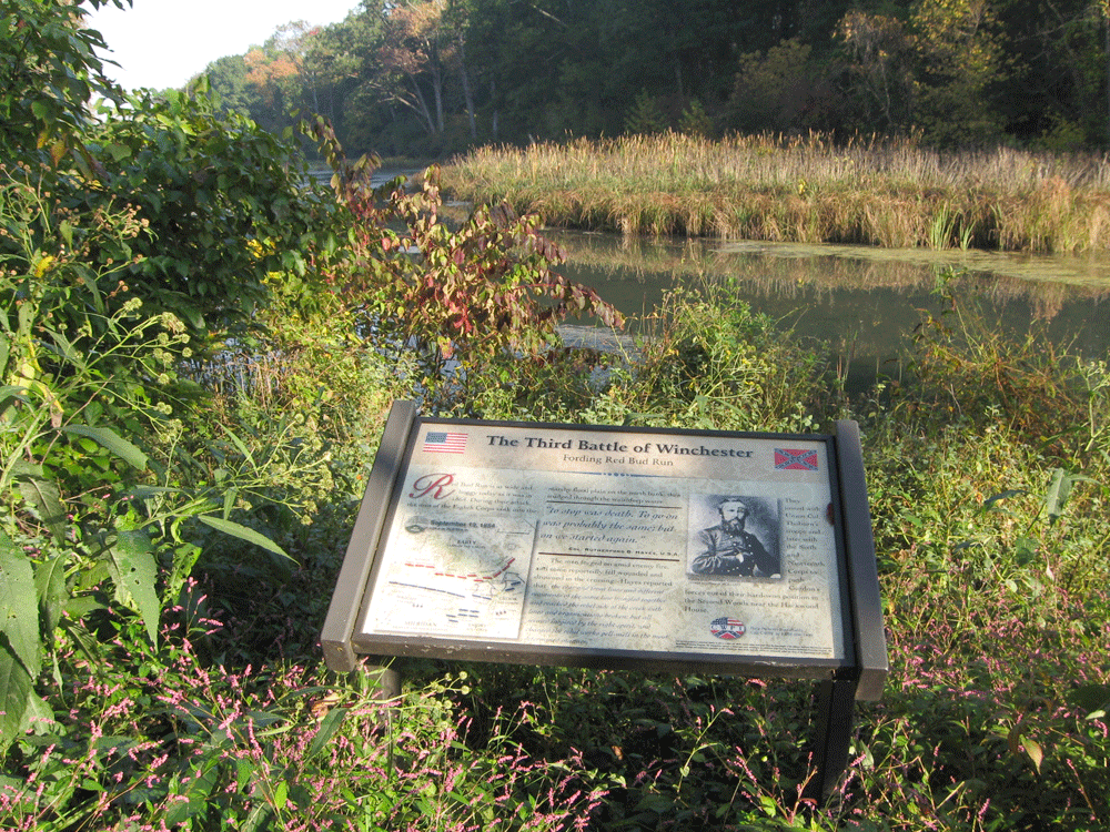
The view faces northwest from the south bank of Red Bud Run. The wayside marker is next to the walking trail’s pedestrian bridge across the boggy run. Duval’s Division of the Union Eighth Corps waded across here under fire to outflank the Confederates of Gordon’s Division in the Second Woods. The successful attack forced the Confederate line back toward Winchester and, by the end of the day, led to its collapse.
From the marker:
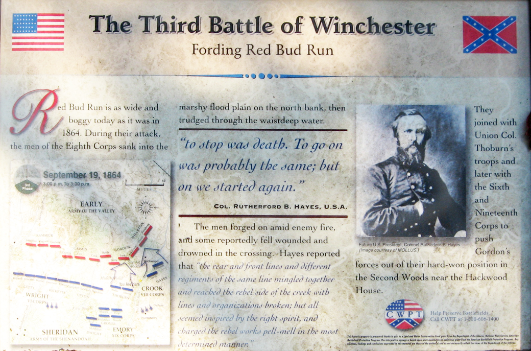
The Third Battle of Winchester
Fording Red Bud Run
“To stop was death. To go on was probably the same; but on we started again.”
Col. Rutherford B. Hayes, U.S.A.
Red Bud Run is as wide and boggy today as it was in 1864. During their attack, the men of the Eighth Corps sank into the marshy flood plain on the north bank, then trudged through the waistdeep water.
The men forged on amid enemy fire and some reportedly fell wounded and drowned in the crossing. Hayes reported that “the rear and front lines and different regiments of the same line mingled together and reached the rebel side of the creek with lines and organizations broken; but all seemed inspired by the right spirit, and charged the rebel works pell-mell in the most determined manner.”
They joined Union Col. Thoburn’s troops and later with the Sixth and Nineteenth Corps to push Gordon’s forces out of their hard-won position in the Second Woods near the Hackwood House.
From the caption to the photo:
Future U.S. President Colonel Rutherford B. Hayes (image courtesy of MOLLUS)
The “Fording Red Bud Run” wayside marker is about 0.5 mile south of the Redbud Road trailhead along the walking tour for the Civil War Trust’s Third Winchester battlefield site. The trailhead can be reached from the Interstate 81 interchange with U.S. 11 north of Winchester. At the light immediately to the east of the interchange take Redbud Road (County Road 661) south 0.85 mile. Parking for the trailhead is on the south side of Redbud Road. (39°12’08.8″N 78°07’35.5″W)