
3rd Winchester • Tour the Battlefield • Battle Maps • Battle Facts • The Armies
—
Red Bud Run • Star Fort • Fort Collier • Rutherford’s Farm
Stephenson Depot • National Cemetery • Confederate Cemetery
“The Middle Field – Bloodiest Encounter in the Shenandoah Valley” waysdie marker is about a mile south of th Redbud Road trailhead of the walking tour for the Civil War Trust’s Third Winchester battlefield site northeast of Winchester, Virginia. (see map below)
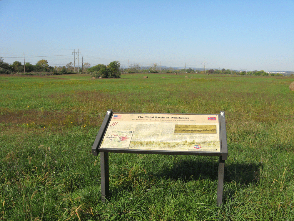
The marker looks west across the field where Grover’s Union Division lost 1.500 casualties.
From the marker:
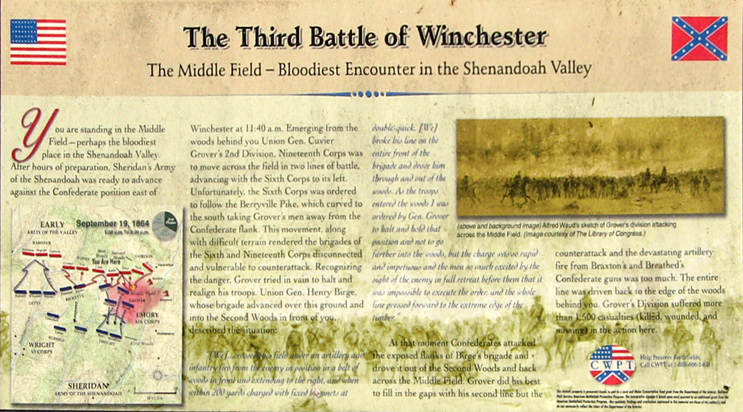
The Third Battle of Winchester
The Middle Field – Bloodiest Encounter in the Shenandoah Valley
You are standing in the Middle Field – perhaps the bloodiest place in the Shenandoah Valley. After hours of preparation, Sheridan’s Army of the Shenandoah was ready to advance against the Confederate position east of Winchester at 11:40 a.m. Emerging from the woods behind you Union Gen. Cuvier Grover’s 2nd Division, Nineteenth Corps was to move across the field in two lines of battle, advancing with the Sixth Corps to its left. Unfortunately, the Sixth Corps was ordered to follow the Berryville Pike, which curved to the south taking Grover’s men away from the Confederate flank. This movement, along with difficult terrain rendered the brigades of the Sixth and Nineteenth Corps disconnected and vulnerable to counterattack. Recognizing the danger, Grover tried in vain to halt and realign his troops. Union Gen. Henry Birge, whose brigade advanced over this ground and into the Second Woods in front of you, described the situation:
“[We]…crossed this field under an artillery and infantry fire from the enemy in position in a belt of woods in front and extending to the right, and when within 200 yards charged with fixed bayonets at double-quick. [We] broke his line on the entire front of the brigade and drove him through and out of the woods. As the troops entered the woods I was ordered by Gen. Grover to halt and hold that position and not to go farther into the woods, but the charge was so rapid and impetuous and the men so much excited by the sight of the enemy in full retreat before them that it was impossible to execute the order, and the whole line pressed forward to the extreme edge of the timber.”
At that moment Confederates attacked the exposed flanks of Birge’s brigade and drove it out of the Second Woods and back across the Middle Field. Grover did his best to fill the gaps with his second line but the counterattack and the devastating artillery fire from Braxton’s and Breathed’s Confederate guns was too much. The entire line was driven back to the edge of the woods behind you. Grover’s Division suffered more than 1,500 casualties (killed, wounded, and missing) in the action here.
From the caption to the drawing:
(above and background image) Alfred Waud’s sketch of Grover’s Division attacking across the Middle Field. (Image courtesy of The Library of Congress)
The Middle Field wayside marker is along the walking tour for the Civil War Trust’s Third Winchester battlefield site. It is about 1 mile from the Redbud Road trailhead. The trailhead can be reached from the Interstate 81 interchange with U.S. 11 north of Winchester. At the light immediately to the east of the interchange take Redbud Road (County Road 661) south 0.85 mile. Parking for the trailhead is on the south side of Redbud Road. (39°11’54.4″N 78°07’32.0″W)