
Battle of Chancellorsville • Tour the Battlefield • Monuments & Markers • The Armies
The Battles of Fredericksburg – E44 Virginia historical marker is in Fredericksburg, Virginia, on the north side of Lafayette Boulevard (US 1B). It commemorates both the Battle of Fredericksburg in December of 1862 and the fighting in Fredericksburg as part of the Chancellorsville Campaign in May of 1863, often referred to as the Second Battle of Fredericksburg.
From the marker
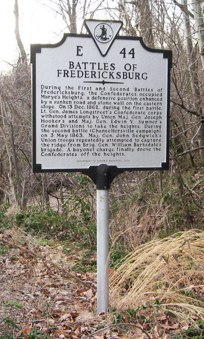
E44
Battles of Fredericksburg
During the First and Second Battles of Fredericksburg, the Confederates occupied Marye’s Heights, a defensive position enhanced by a sunken road and stone wall on the eastern slope. On 13 Dec. 1862, during the first battle, Lt. Gen. James Longstreet’s Confederate Corps withstood attempts by Union Major General Joseph Hooker’s and Majo. Gen. Edwin V. Sumner’s Grand Divisions to take the heights. During the second battle (Chancellorsville Campaign) on 3 May 1863, Maj. Gen. John Sedgwick’s Union troops repeatedly attempted to capture the ridge from Brig. Gen. William Barksdale’s brigade. A bayonet charge finally drove the Confederates off the heights.
Department of Historic Resources 2000
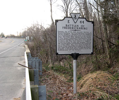
Location of the Battles of Fredericksburg marker
The marker is in Fredericksburg on the north side of Lafayette Boulevard (US 1B). It is about 250 yards east of the intersection with the Blue and Gray Parkway (Virginia Route 3) and 500 yards south and west of the National Park Visitor Center. (38°17’28.2″N 77°28’11.2″W)