
Battle of Chancellorsville • Tour the Battlefield • Monuments & Markers • The Armies
 The Chancellorsville Intersection wayside marker is at Stop 3 on the Chancellorsville Battlefield Auto Tour.
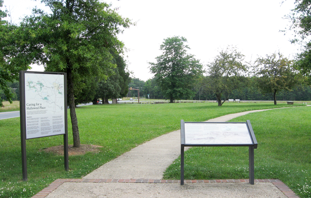
The Chancellorsville intersection was the heart of the Federal position in the battle, with Hooker’s headquarters at the Chancellor House. This view looks south from the parking area of Stop 3 on the Auto Tour. A path leads to the Chancellor House ruins, whose foundation and steps can still be seen. Running left to right across the photo, Plank Road (known as Orange Plank Road in 1863) is today a four lane divided highway.
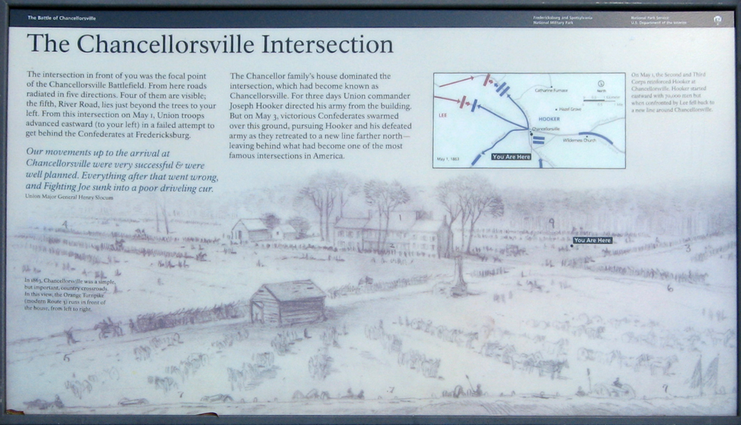
Text from the marker:
The Chancellorsville Intersection
The intersection in front of you was the focal point of the Chancellorsville Battlefield. From here roads radiated in five directions. Four of them are visible; the fifth, River Road, lies just beyond the trees to your left. From this intersection on May 1, Union troops advanced eastward (to your left) in a failed attempt to get behind the Confederates at Fredericksburg.
Our movements up to the arrival at Chancellorsville were very successful & were well planned. Everything after that went wrong, and Fighting Joe sunk into a poor driveling cur.
-Union Major General Henry Slocum
The Chancellor family’s house dominated the intersection, which had become known as Chancellorsville. For three days Union commander Joseph Hooker directed his army from the building. But on May 3, victorious Confederates swarmed over this ground, pursuing Hooker and his defeated army as they retreated to a new line farther north – leaving behind what had become one of the most famous intersections in America.
From the caption to the drawing in the lower left:
In 1863, Chancellorsville was a simple but important, country crossroads. In this view, the Orange Turnpike (modern Route 3) runs in front of the house, from left to right.
From the caption to the map on the upper right:
On May 1, the Second and Third Corps reinforced Hooker at Chancellorsville. Hooker started eastward with 30,000 men but when confronted by Lee fell back to a new line around Chancellorsville.
Location of the Marker
The marker is at the south side of the parking area for the Chancellor House Ruins. It is just north of the intersection of Elys Ford Road with the Plank Road, Virginia Route 3. The parking area is on the west side of Elys Ford Road. (38°18’34.3″N 77°38’04.6″W)
(go to main Stop 3 page)
(go to the main Chancellorsville Battlefield Auto Tour page)