
Battle of Chancellorsville • Tour the Battlefield • Monuments & Markers • The Armies
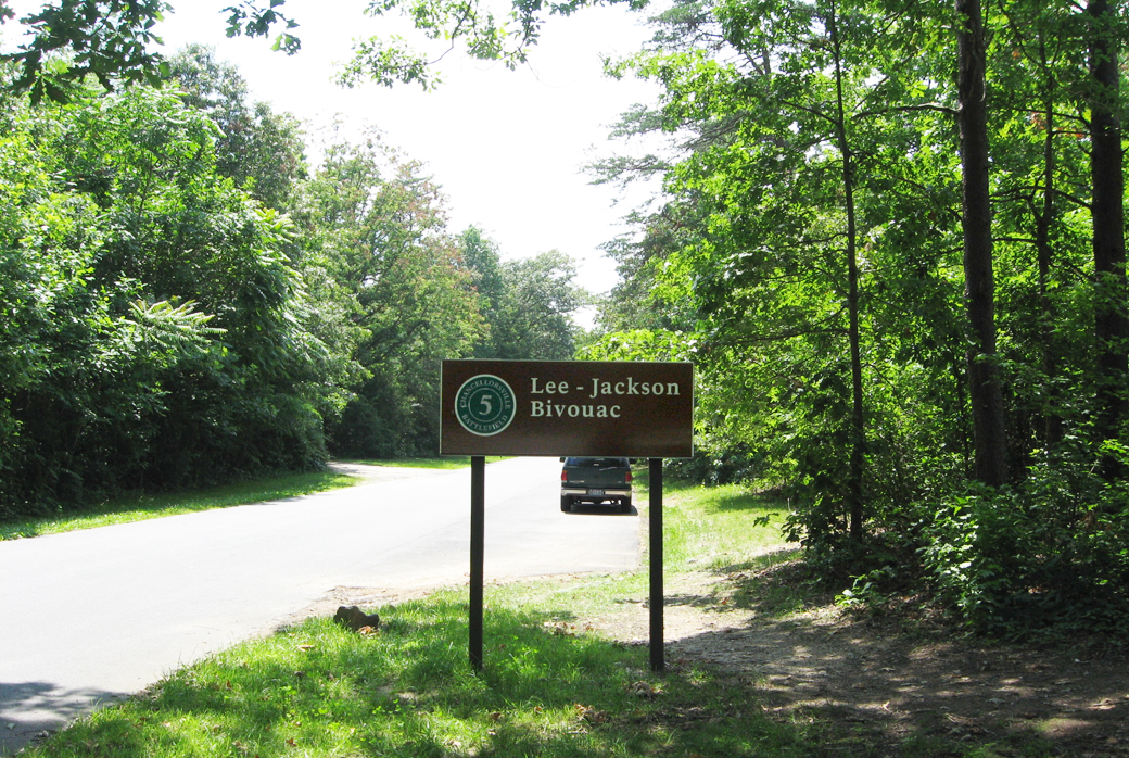
 Stop 5 of the Battle of Chancellorsville Auto Tour is just west and north of the intersection of Old Plank Road and Furnace Road.
The Chancellorsville Campaign – Orange Plank Road historical marker is on the north side of McLaws Drive just east of the Plank Road intersection and Stop 5.
Here on the evening of May 1, 1863 Confederate General Robert E. Lee and Lieutenant General Thomas J. “Stonewall” Jackson met to plan what would become Jackson’s flank march and attack for the next day. The attack threatened to destroy the larger Union army and caused it to retreat back across the Rappahannock River.
It was Lee’s most daring attack and Jackson’s most brilliant plan – and his last, as he was mortally wounded by friendly fire the next day. This was the the final meeting of two of the most iconic leaders of the Civil War.
Lee-Jackson Bivouac Stone
The Lee-Jackson Bivouac monument marks the last meeting between General Robert E. Lee and Lieutenant General Thomas J. “Stonewall” Jackson. Here they planned Jackson’s flank attack on Hooker’s Army.
According to usage at the time of the Civil War, to “bivouac” was to sleep in the field without tents. On the night of May 1 Jackson bedded down on the saddle blanket of one of his staff, Jedediah Hotchkiss, using his saddle for a pillow and his overcoat as a blanket. Lee slept on the soft needles under a pine tree, wrapped in his cape.
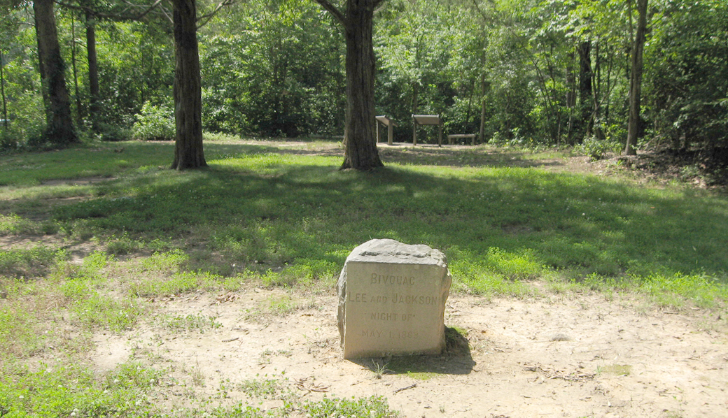
The monument is one of ten placed by the Reverend James Powers Smith on battlefields around Fredericksburg and Spotsylvania County. Smith had been a lieutenant on Jackson’s staff. The monuments were largely paid for by businessman Thomas F. Ryan. Other Smith monuments are the Arm of Stonewall Jackson at Ellwood, Stuart and Pelham at Fredericksburg, Jackson on the Field at Fredericksburg, Lee’s Hill at Fredericksburg, Battle of Salem Church, Stonewall Jackson died at Guinea Station, Lee to the Rear at the Wilderness, and Lee’s Headquarters at Spotsylvania.
Text from the monument:
Bivouac
Lee and Jackson
Night of
May 1, 1863

Two wayside markers explain what happened here:
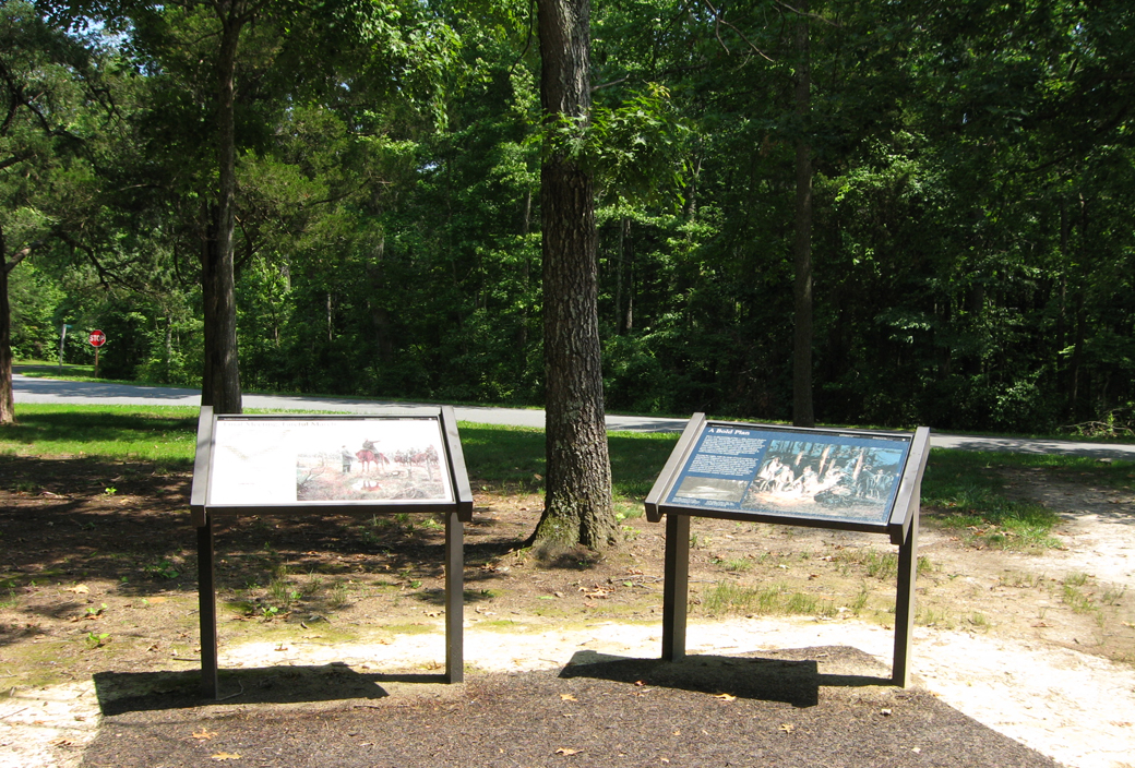
The “Final Meeting, Fateful March” wayside marker (on left) and the “A Bold Plan” wayside marker (right)
Final Meeting, Fateful March wayside marker
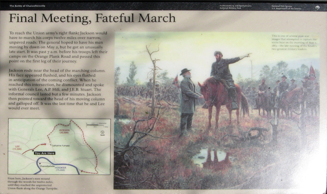
Text from the “Final Meeting, Fateful March” marker:
Final Meeting, Fateful March
To reach the Union army’s right flank, Jackson would have to march his corps twelve miles over narrow, unpaved roads. The general hoped to have his men moving by dawn on May 2, but he got an unusually late start. It was past 7 a.m. before his troops left their camps on the Orange Plank Road and passed this point on the first leg of their journey.
Jackson rode near the head of the marching column. His face appeared flushed, and his eyes flashed in anticipation of the coming conflict. When he reached the intersection, he dismounted and spoke with Generals Lee, A.P. Hill, and J.E.B. Stuart. The informal council lasted but a few minutes. Jackson then pointed toward the head of his moving column and galloped off. It was the last time that he and Lee would ever meet.
From the caption to the photo:
This is one of several post-war images that attempted to capture the scene here on the morning of May 2, 1863 – the last meeting of the South’s two greatest military leaders.
From the caption to the map:
From here, Jackson’s men wound through the woods for twelve miles until they reached the unprotected Union flank along the Orange Turnpike.
A Bold Plan wayside marker
Text from the “A Bold Plan” wayside marker:
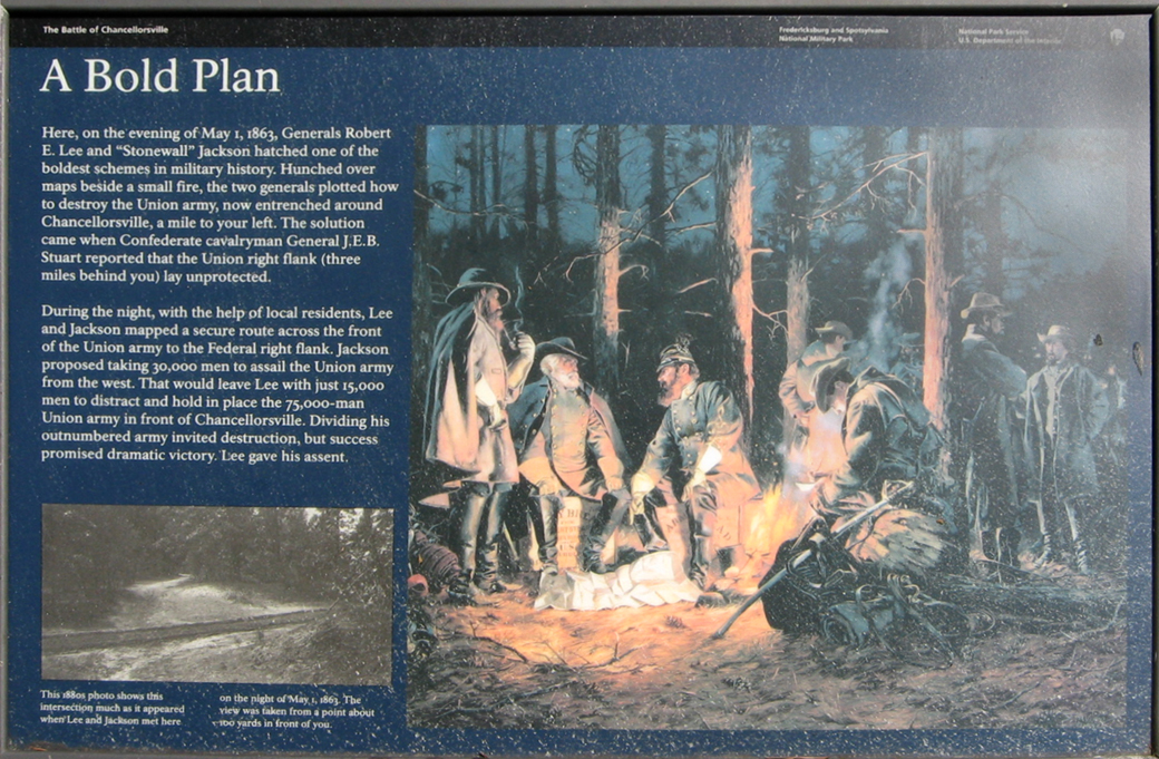
A Bold Plan
Here, on the evening of May 1, 1863, Generals Robert E. Lee and “Stonewall” Jackson hatched one of the boldest schemes in military history. Hunched over maps beside a small fire, the two generals plotted how to destroy the Union army, now entrenched around Chancellorsville, a mile to your left. The solution came when Confederate cavalryman General J.E.B. Stuart reported that the Union right flank (three miles behind you) lay unprotected.
During the night, with the help of local residents, Lee and Jackson mapped a secure route across the front of the Union army to the Federal right flank. Jackson proposed taking 30,000 men to assail the Union army from the west. That would leave Lee with just 15,000 men to distract and hold in place the 75,000-man Union army in front of Chancellorsville. Dividing his outnumbered army invited destruction, but success promised dramatic victory. Lee gave his assent.
From the caption for the photo at the lower left:
This 1880s photo shows this intersection much as it appeared when Lee and Jackson met here on the night of May 1, 1863. The view was taken from a point about 100 yards in front of you.
Location of Stop 5
Stop 5 of the Battle of Chancellorsville Auto Tour is just west and north of the intersection of Old Plank Road and Furnace Road (a continuation of McLaws Drive). (38°17’41.5″N 77°37’33.0″W) A small turnoff is on the north side of Furnace Road just past the Auto Tour sign.
 Directions to the next stop on the Auto Tour:
Continue 1.4 miles ahead on Furnace Road, which ends at a wye with Sickles Avenue and Jackson Trail East. The parking area for Stop 6 is on the left at the wye.
About 0.8 miles ahead the Jackson on the Move wayside Marker is in between stops Five and Six on the north side of the road at the Maury Birplace Site.