
Battle of Chancellorsville • Tour the Battlefield • Monuments & Markers • The Armies
 Tour Stop 6 on the Chancellorsville Battlefield Auto Tour is at the ruins of Catharine Furnace. There is a small parking area here southeast of the wye of the road.
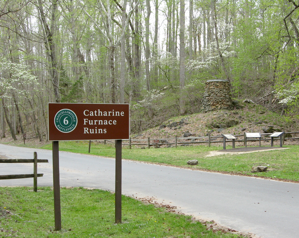
Catharine Furnace
Catharine Furnace produced pig iron from local iron ore deposits. In 1863 it was the center of a small complex of buildings, of which the stone stack of the furnace is the sole survivor.
Charles Welford, the proprietor of Catharine Furnace, told “Stonewall” Jackson about a forest road that he had recently opened that ran from the Furnace to Brock Road. The road (which went past the Wellford’s home) would be ideal for the hidden march around the Union flank Jackson envisioned. Wellford’s son would guide Jackson down the crude road, which some of his men characterized as “no better than an animal trail.”
Three wayside markers are at Catharine Furnace and give more detail on the works, their history, and what happened here during the Battle of Chancellorsville. There is a small parking area on the left.
A Region of Gloom wayside marker
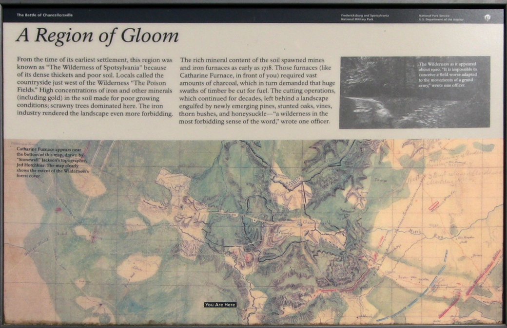
From the marker:
A Region of Gloom
From the time of its earliest settlement, this region was known as “The Wilderness of Spotsylvania” because of its dense thickets and poor soil. Locals called the countryside just west of the Wilderness “The Poison Fields.” High concentrations of iron and other minerals (including gold) in the soil made for poor growing conditions, scrawny trees dominated here. The iron industry rendered the landscape even more forbidding.
The rich mineral content of the soil spawned mines and iron furnaces as early as 1718. Those furnaces (like Catharine Furnace, in front of you) required vast amounts of charcoal, which in turn demanded that huge swaths of timber be cut for fuel. The cutting operations which continued for decades, left behind a landscape engulfed by newly emerging pines, stunted oaks, vines, thorn bushes, and honeysuckle — “a wilderness in the most forbidding sense of the word,” wrote one officer.
From the caption to the map:
Catherine Furnace apears near the bottom of this map, drawn by “Stonewall” Jackson’s topographer, Jed Hotchkiss. The map clearly shows the extent of the wilderness’s forest cover.
From the caption to the photo at upper right:
The Wilderness as it appeared about 1900. “It is impossible to conceive a field worse adapted to the movements of a grand army,’ wrote one officer.
Catharine Furnace wayside marker
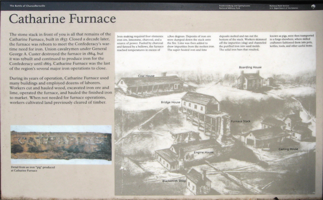
Text from the marker:
Catharine Furnace
The stone stack in front of you is all that remains of the Catharine Furnace, built in 1837. Closed a decade later, the furnace was reborn to meet the Confederacy’s wartime need for iron. Union cavalrymen under General George A. Custer destroyed the furnace in 1864, but it was rebuilt and continued to produce iron for the Confederacy until 1865. Catharine Furnace was the last of the region’s several major operations to close.
During its years of operation, Catharine Furnace used many buildings and employed dozens of laborers. Workers cut and hauled wood, excavated iron ore and lime, operated the furnace, and hauled the finished iron to market. When not needed for furnace operations, workers cultivated land previously cleared of timber.
From the sidebar for the illustration:
Iron-making required four elements: iron ore, limestone, charcoal, and a source of power. Fueled by charcoal and fanned by a bellows, the furnace reached temperatures in excess of 2,800 degrees. Deposits of iron ore were dumped down the stack onto the fire. Lime was then added to draw impurities from the molten iron. The super-heated iron and lime deposits melted and ran out the bottom of the stack. Workers skimmed off the impurities (slag) and channeled the purified iron into sand molds. The solid iron bars that resulted, known as pigs, were then transported to a forge elsewhere, where skilled craftsmen fashioned them into pots, kettles, tools and other useful items.
From the caption for the photo on the lower left:
Detail of an iron ‘pig’ produced at Catharine Furnace.
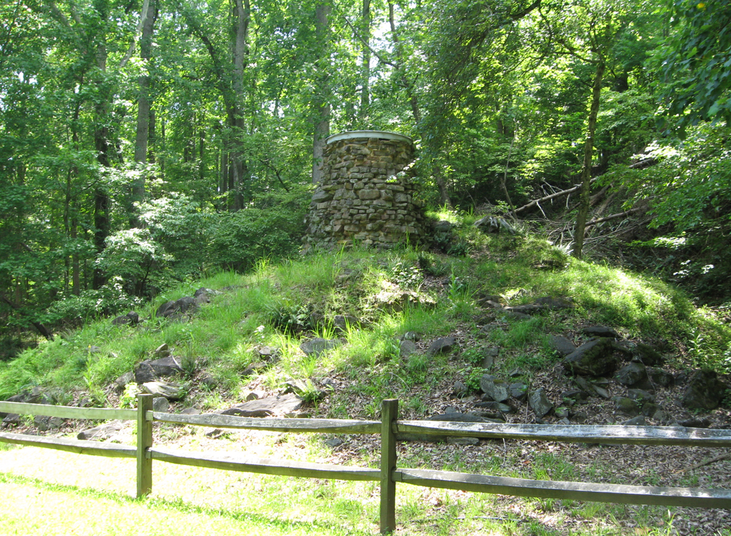
The Furnace Stack is the only structure to survive from Catharine Furnace
Text from the marker:
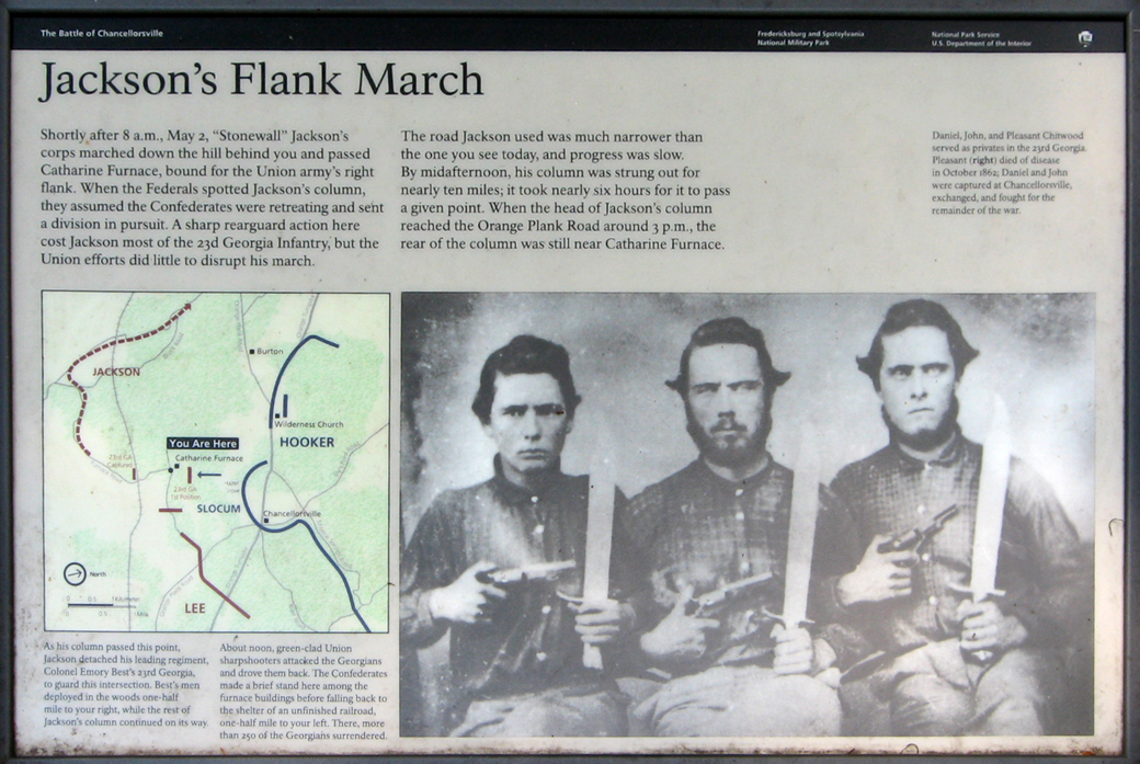
Jackson’s Flank March
Shortly after 8 a.m., May 2, “Stonewall” Jackson’s corps marched down the hill behind you and passed Catharine Furnace, bound for the Union Army’s right flank. When the Federals spotted Jackson’s column, they assumed the Confederates were retreating and sent a division in pursuit. A sharp rearguard action here cost Jackson most of the 23rd Georgia Infantry, but the Union efforts did little to disrupt his march.
The road Jackson used was much narrower than the one you see today, and progress was slow. By midafternoon, his column was strung out for nearly ten miles; it took nearly six hours for it to pass a given point. When the head of Jackson’s column reached the Orange Plank Road around 3 p.m., the rear of the column was still near Catharine Furnace.
From the text below the map:
As his column passed this point, Jackson detached his leading regiment, Colonel Emory Best’s 23rd Georgia, to guard this intersection. Best’s men deployed in the woods one-half mile to your right, while the rest of Jackson’s column continued on its way.
About noon, green-clad Union sharpshooters attacked the Georgians and drove them back. The Confederates made a brief stand here among the furnace buildings before falling back to the shelter of an unfinished railroad, one-half mile to your left. There, more than 250 of the Georgians surrendered.
From the caption to the photo:
Daniel, John, and Pleasant Chitwood served as privates in the 23rd Georgia. Pleasant (right) died of disease in October 1862; Daniel and John were captured at Chancellorsville., exchanged, and fought for the remainder of the war.
Map and directions to Tour Stop 6
Tour Stop 6 is just south of the wye where Furnace Road, Sickles Drive, and Jackson Trail East come together. (38°17’20.1″N 77°38’52.8″W)
 Directions to the next stop on the Auto Tour:
Turn north on Sickles Drive (the paved road) and continue 0.8 mile to the wye with Slocum Avenue. Turn right onto Slocum Avenue and continue 0.5 mile. Stop 7 is on the right.
The Chancellorsville Campaign: May 2-3 Slocum’s Corps historical marker is along the way to Stop 7 but is not part of the Auto Tour. It is at the intersection of Sickles Dtive, Stuart Drive and Slocum Drive about 0.85 mile north of Catharine Furnace.