
Battle of Fredericksburg • Tour the Battlefield • Monuments & Markers • Armies
The monument and markers to “The gallant Pelham” are at the corner of Tidewater Trail (Business US 17 and Virginia 2) and Benchmark Road. (see map at bottom of page) The markers are not on the Auto Tour.
This was the extreme right flank of the Confederate army. As Franklin’s Federal troops advanced, they were held up for over two hours by the artillery – eventually one single gun – of youthful Confederate Major John Pelham.

The two wayside markers have been moved a few yards to the southwest since this photo was taken.
A small monument and several markers are clustered on the corner:
The Battle of Fredericksburg wayside marker
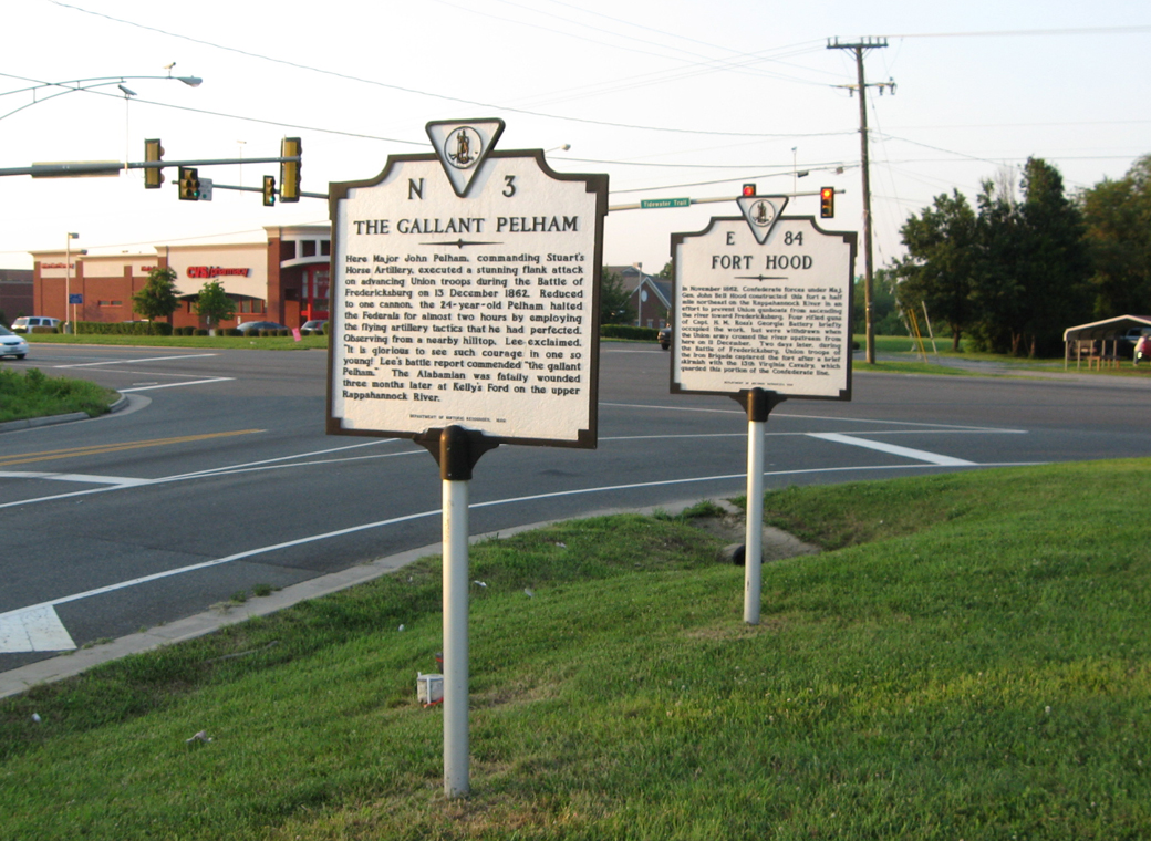
The Gallant Pelham and Fort Hood Virginia historical markers
The Gallant Pelham wayside marker
Stuart and Pelham monument
Location
The Pelham markers are 3.7 miles southeast of downtown Fredericksburg and 1.1 miles southeast of the Slaughter Pen site via Business Route US 17. (38°15’09.6″N 77°25’34.5″W)