
Battle of Fredericksburg • Tour the Battlefield • Monuments & Markers • Armies
The Seeking Cover wayside marker is along the Sunken Road Trail, at Stop One on the Battlefield Auto Tour.
Text from the marker:
Seeking Cover
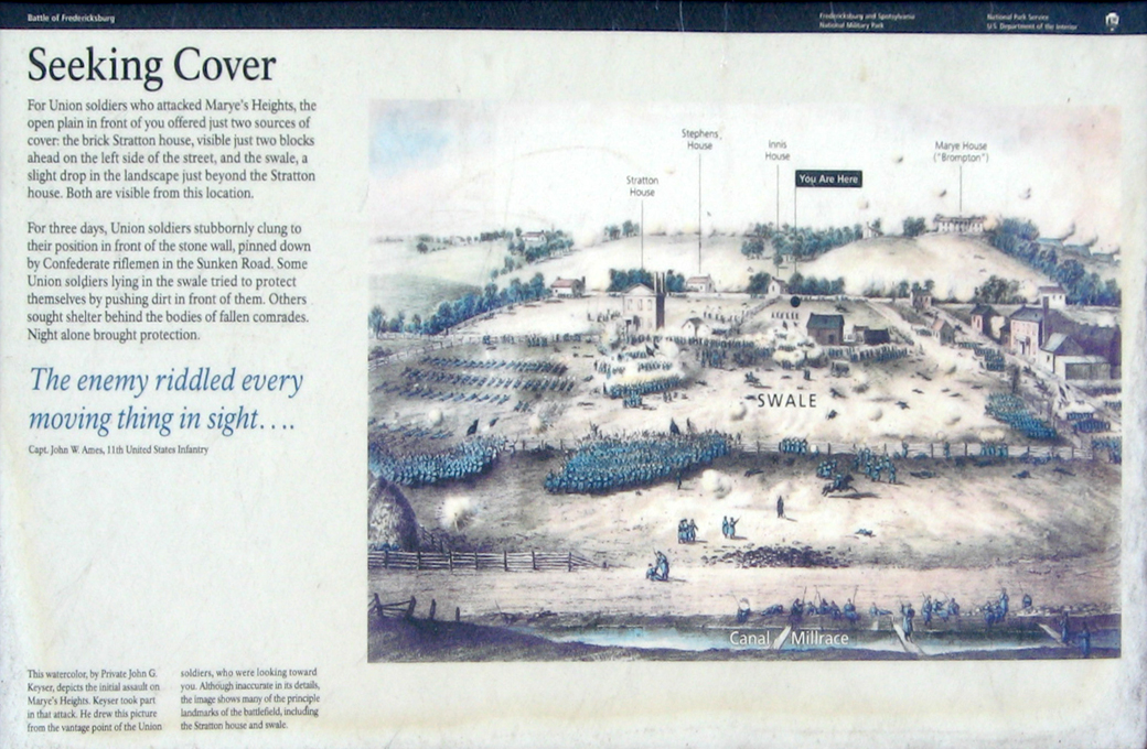
For Union soldiers who attacked Marye’s Heights, the open plain in front of you offered just two sources of cover: the brick Stratton house, visible just two blocks ahead on the left side of the street, and the swale, a slight drop in the landscape just beyond the Stratton house. Both are visible from this location.
For three days, Union soldiers stubbornly clung to their position in front of the stone wall, pinned down by Confederate riflemen in the Sunken Road. Some Union soldiers lying in the swale tried to protect themselves by pushing dirt in front of them. Others sought shelter behind the bodies of fallen comrades. Night alone brought protection.
The enemy riddled every moving thing in sight ….
Capt. John W. Ames, 11th United States Infantry.
From the caption at the lower left:
This watercolor, by Private John G. Keyser, depicts the initial assault on Marye’s Heights. Keyser took part in that attack. He drew this picture from the vantage point of the Union soldiers, who were looking toward you. Although inaccurate in its details, the image shows many of the principle landmarks of the battlefield, including the Stratton house and swale.
Location of the marker
The marker is about 25 yards northeast of the Innis House, about 300 yards north of the Visitor Center and 30 yards east of the Sunken Road. (38°17’45.8″N 77°28’05.3″W). It is across from “The Killing Fields” wayside marker.