
Battle of Fredericksburg • Tour the Battlefield • Monuments & Markers • Armies
 Chatham is Stop Two on the Battle of Fredericksburg Auto Tour. It is on the north side of the Rapahannock River. (see map below) Several rooms of the Georgian Style mansion and the surviving 84 acres of the estate are open to the public and administered by the National Park Service, which uses Chatham Manor as park headquarters.

The Georgian-style manor house at Chatham is open to the public.
Tour the grounds at Chatham
See the Civil war wayside markers and displays at Chatham
Chatham Manor was built between 1768 and 1771, and was named after the Earl of Chatham, William Pitt, who was Prime Minister of Great Britain at the time. By the Civil War the estate covered 1,280 acres and was home to James Horace Lacy, who served throughout the war as a Confederate staff officer. Lacy’s family left Chatham when Union troops arrived in April of 1862 and the estate became headquarters for Union Major General Irvin McDowell. President Lincoln met with McDowell at the time and stayed at Chatham.
During the Battle of Fredericksburg in December Chatham became an artillery position and then a hospital. Walt Whitman and Clara Barton served there as well as Dr. Mary Walker, the only woman from the Civil War to receive the Medal of Honor. At one point 130 Union soldiers were known to be buried there, and although most of these have been moved to Fredericksburg National Cemetery, three still remain. Chatham continued its role as hospital after the Battle of Chancellorsville in 1863 and through the Battles of the Wilderness and Spotsylvania in 1864.
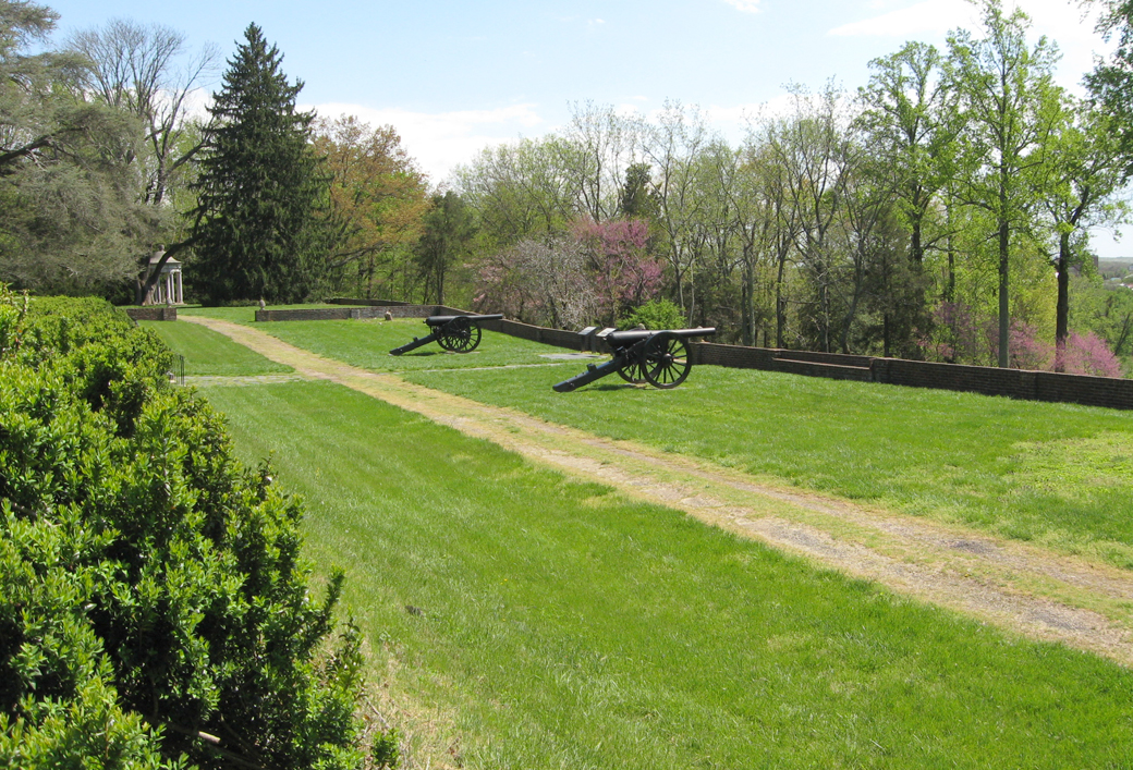
Heavy siege guns on the terrace of Chatham Manor facing across the Rappahannock River to Fredericksburg
Directions to Chatham Manor
Leaving Stop One of the Auto Tour at the Visitor Center, turn left (northeast) on Lafayette Boulevard for 0.75 mile until it ends at Sophia Street. Turn left (northwest) on Sophia for 0.4 mile to William Street. Turn right (northeast) on William Street onto the bridge across the Rappahannock River. Stay on William Street for 0.3 mile as it crosses the river and becomes Kings Highway. Turn left (north) onto Chatham Heights Road and in 200 yards turn left again onto Chatham Lane, which is marked with a National Park sign for Chatham Manor. Follow Chatham Lane 0.2 mile to the parking area, which is on the right.
Directions to the next stop on the Auto Tour:
 To reach Stop Three, leave Chatham Manor by Chatham Drive, which descends the river bluff in front of the manor and ends at King’s Highway. From here you will retrace your path to the Visitor Center, then continue to Stop Three. Turn Right (southwest) onto King’s highway, which immediately crosses the Rappahannock River and becomes William Street. Get into the left lane. Immediately after crossing the bridge turn left (southeast) onto Sophia Street. Stay on Sophia Street for 0.4 mile. Just before the railroad overpass turn right (southwest) onto Lafayette Boulevard. Stay on Lafayette for 1.4 miles, past the Visitor Center and 350 yards past the intersection with the Blue and Grey Parkway, Virgnia Route Three. Turn left (south) onto Lee Drive, marked with National Park signs. The parking area for Stop three is 200 yards ahead on the right.