
Harpers Ferry Main • Tour the Battlefield > Bolivar Heights
The Bolivar Heights Trail marker is west of Harpers Ferry on Bolivar Heights in Harpers Ferry National Historic Park. The marker is at the intersection of Whitman Avenue and Prospect Avenue next to the parking area for the Bolivar Heights trailhead.
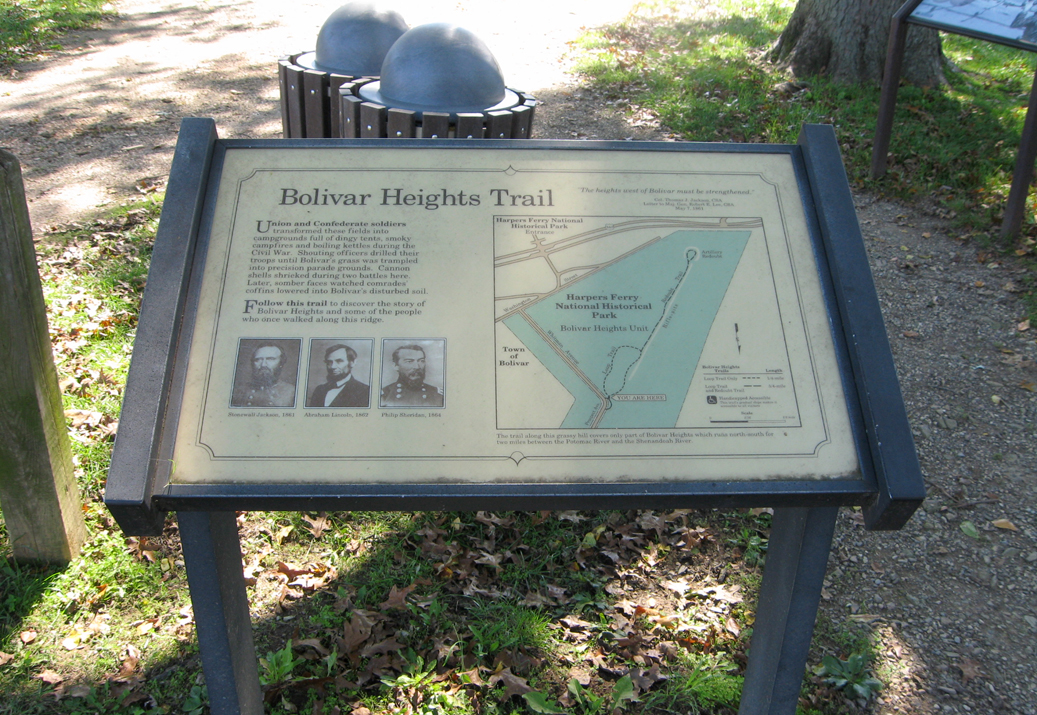
From the marker:
Bolivar Heights Trail
“The heights west of Bolivar must be strengthened.”
Col Thomas J. Jackson, CSA
Letter to Maj. Gen. Robert E. Lee, CSA
May 7, 1861
Union and Confederate soldiers transformed these fields into campgrounds full of dingy tents, smoky campfires and boiling kettles during the Civil War. Shouting officers drilled their troops until Bolivar’s grass was trampled into precision parade grounds. Cannon shells shrieked during two battles here. Later, somber faces watched comrades’ coffins lowered into Bolivar’s disturbed soil.
Follow this trail to discover the story of Bolivar Heights and some of the people who walked along this ridge.
The trail along this grassy hill covers only part of Bolivar Heights which runs north-south for two miles between the Potomac River and the Shenandoah River.
Captions for photos:
Stonewall Jackson, 1861
Abraham Lincoln, 1862
Philip Sheridan, 1864
From the map legend:
Bolivar Heights Trails Length
Loop Trail only 1/4 mile
Loop Trail
and Redoubt Trail 3/4 mile
Handicapped Accessible
The trails’ gradual slope makes it accessible for all wheelchairs.
