
Harpers Ferry Main • Tour the Battlefield > Bolivar Heights
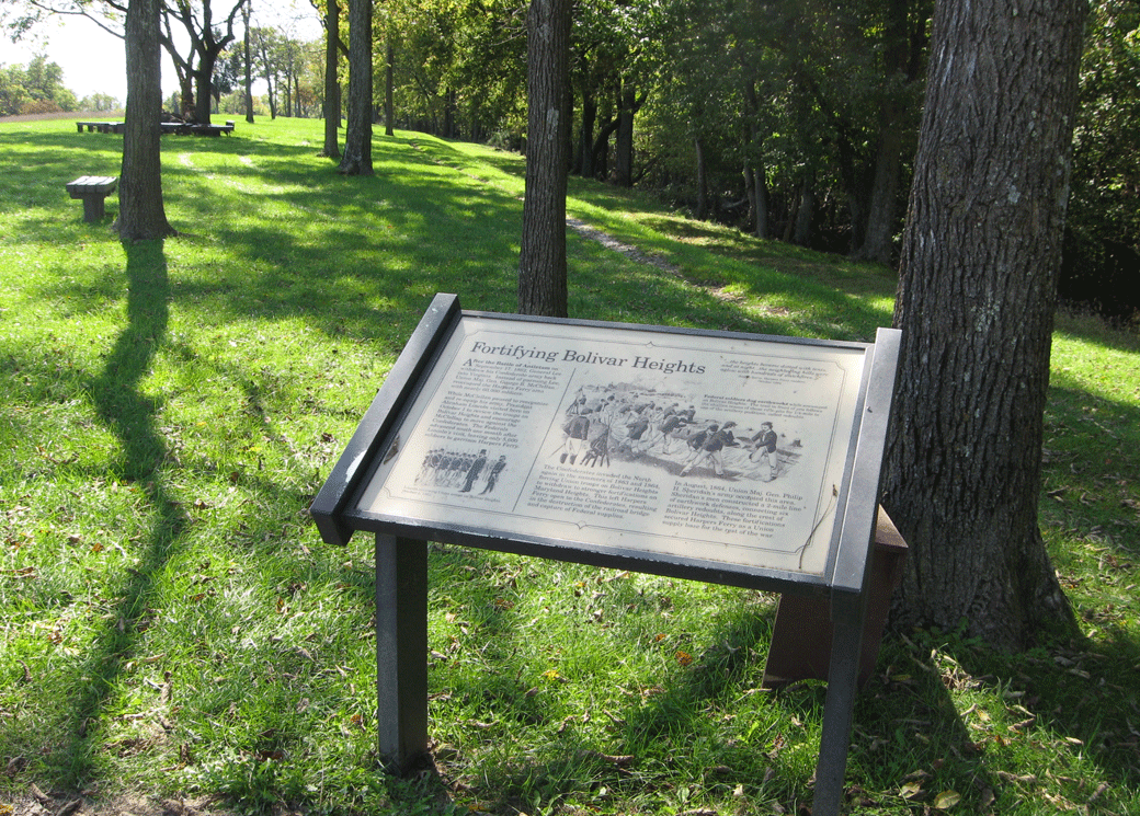
The Fortifying Bolivar Heights wayside marker is about 260 yards south of the trailhead of the Union Battle Line Trail on Bolivar Heights in Harpers Ferry National Historical Park.
Looking southeast from the Union Position Loop Trail, which loops back to the north at this point. The Redoubt Trail continues south another 350 yards from here, following the rifle pits which can still be seen along the edge of the woods to the right.
From the marker:
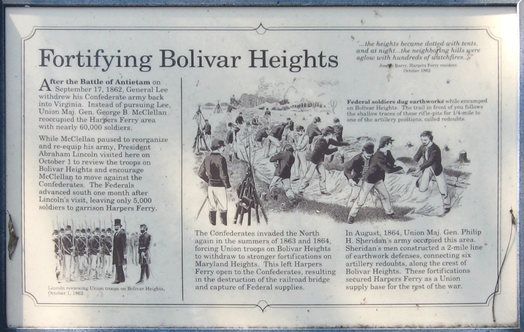
Fortifying Bolivar Heights
“…the heights became dotted with tents, and at night…the neighboring hills were aglow with hundreds of watchfires…”
Joseph Barry,
Harpers Ferry resident
October 1862
After the Battle of Antietam on September 17, 1862, General Lee withdrew his Confederate army back into Virginia. Instead of pursuing Lee, Union Maj. Gen. George B. McClellan reoccupied the Harpers Ferry area with nearly 60,000 soldiers.
While McClellan paused to reorganize and re-equip his army, President Abraham Lincoln visited here on October 1 to review the troops on Bolivar Heights and encourage McClellan to move against the Confederates. The Federals advanced south one month after Lincoln’s visit, leaving only 5,000 soldiers to garrison Harpers Ferry.
The Confederates invaded the North again in the summers of 1863 and 1864, forcing Union troops on Bolivar Heights to withdraw to stronger fortifications on Maryland Heights. This left Harpers Ferry open to the Confederates resulting in the destruction of the railroad bridge and capture of Federal supplies.
In August, 1864, Union Maj. Gen. Philip H. Sheridan’s army occupied this area. Sheridan’s men constructed a 2-mile line of earthwork defenses, connecting six artillery redoubts, along the crest of Bolivar Heights. These fortifications secured Harpers Ferry as a Union supply base for the rest of the war.
Caption from the illustration on the left:
Lincoln reviewing Union troops on Bolivar Heights, October 1, 1862.
Caption from the large illustration:
Federal soldiers dug earthworks while encamped on Bolivar Heights. The trail in front of you follows the shallow traces of these rifle-pits for 1/4-mile to one of the artillery positions, called redoubts.
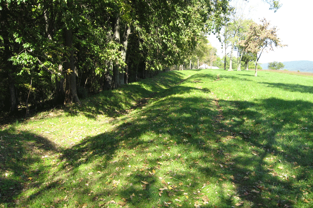
The Federal rifle pits on Bolivar Heights extend over 500 yards along the west side of the ridge. A walking trail follows the entrenchments. Today they look into dense woods, but during the war they had a clear view down the steep slope of Bolivar Heights and across the valley to Schoolhouse Ridge. Two trails lead through the woods to the position of the Union skirmish line on the west side of the trenches.
 Location of the marker
The Fortifying Bolivar Heights wayside marker is about 620 yards south of the trailhead of the Union Battle Line Trail on Bolivar Heights in Harpers Ferry National Historical Park. (39°19’09.0″N 77°45’51.4″W)