
Harpers Ferry Main • Tour the Battlefield > Bolivar Heights
The Protecting the Supply Lines wayside marker is at the southern end of the Redoubt Trail, about 675 yards south of the trailhead on Bolivar Heights in Harpers Ferry National Historical Park.
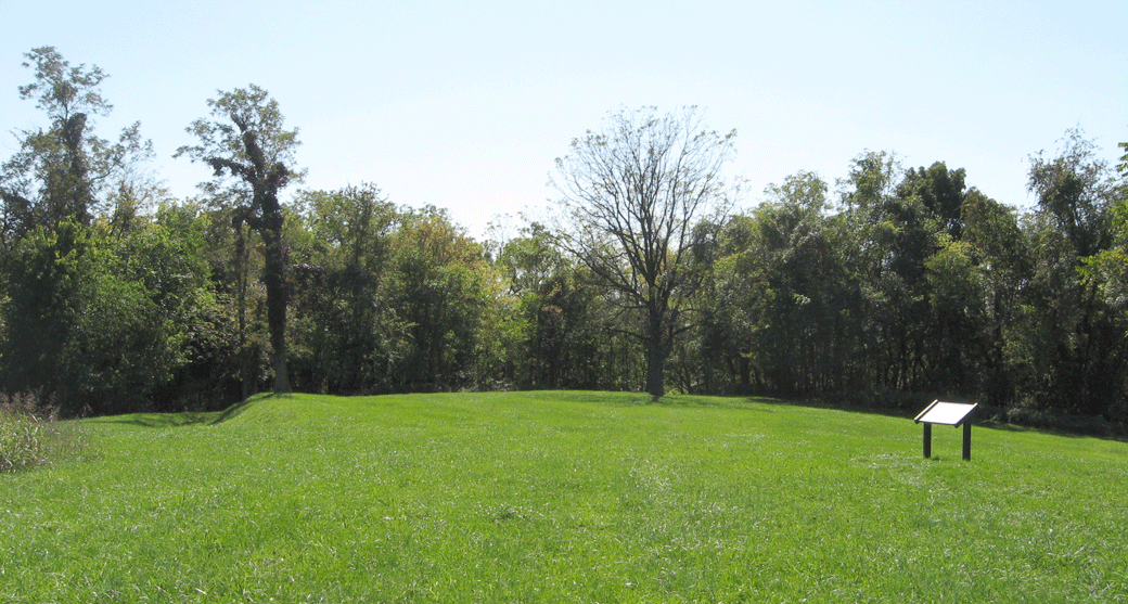
The south end of the Union earthworks on Bolivar Heights ends at a curved artillery redoubt. This was added to the original earthworks in 1864 when Harpers Ferry was a major supply center for the Shenandoah Valley Campaign.
From the marker:
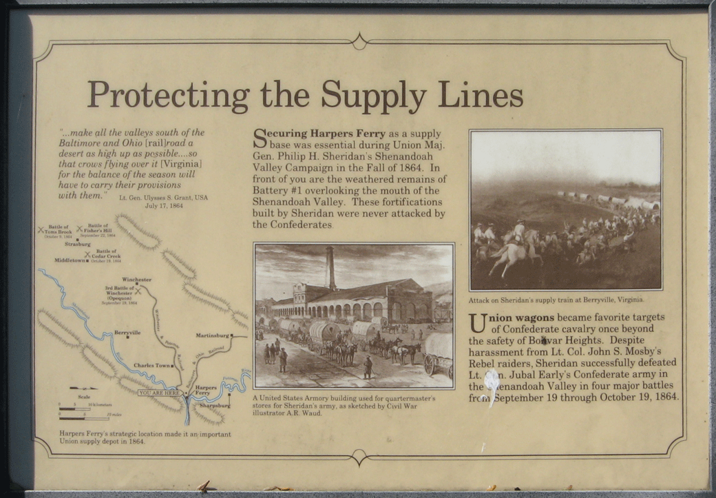
Protecting the Supply Lines
“…make all the valleys south of the Baltimore and Ohio [rail]road a desert as high up as possible…so that crows flying over it [Virginia] for the balance of the season will have to carry their provisions with them.”
Lt. Gen. Ulysses S. Grant, USA
July 17, 1864
Securing Harpers Ferry as a supply base was essential during Union Maj. Gen. Philip H. Sheridan’s Shenandoah Valley Campaign in the Fall of 1864. In front of you are the weathered remains of Battery #1 overlooking the mouth of the Shenandoah Valley. These fortifications built by Sheridan were never attacked by the Confederates.
Union wagons became favorite targets of Confederate cavalry once beyond the safety of Bolivar Heights. Despite harassment from Lt. Col. John S. Mosby’s Rebel raiders, Sheridan successfully defeated Lt. Gen. Jubal Early’s Confederate army in the Shenandoah Valley in four major battles from September 19 through October 19, 1864.
Closeups of the illustrations with captions:
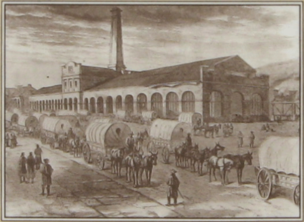
A United States Armory building used for quartermaster’s stores for Sheridan’s army, as sketched by Civil War illustrator A.R. Waud.
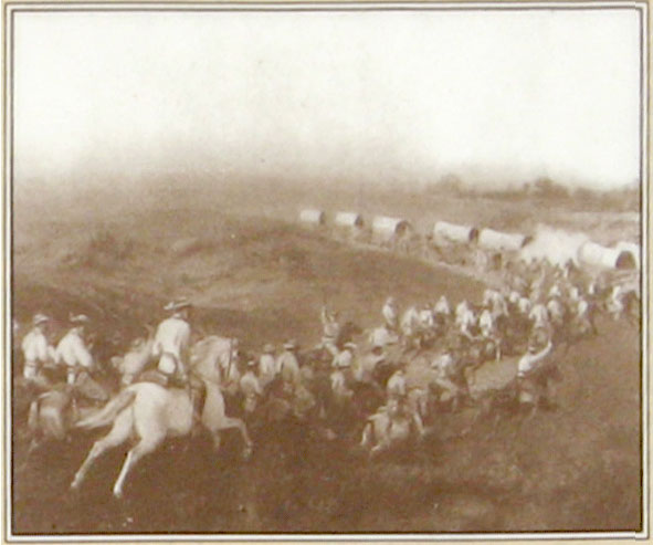
Attack on Sheridan’s supply train at Berryville, Virginia.
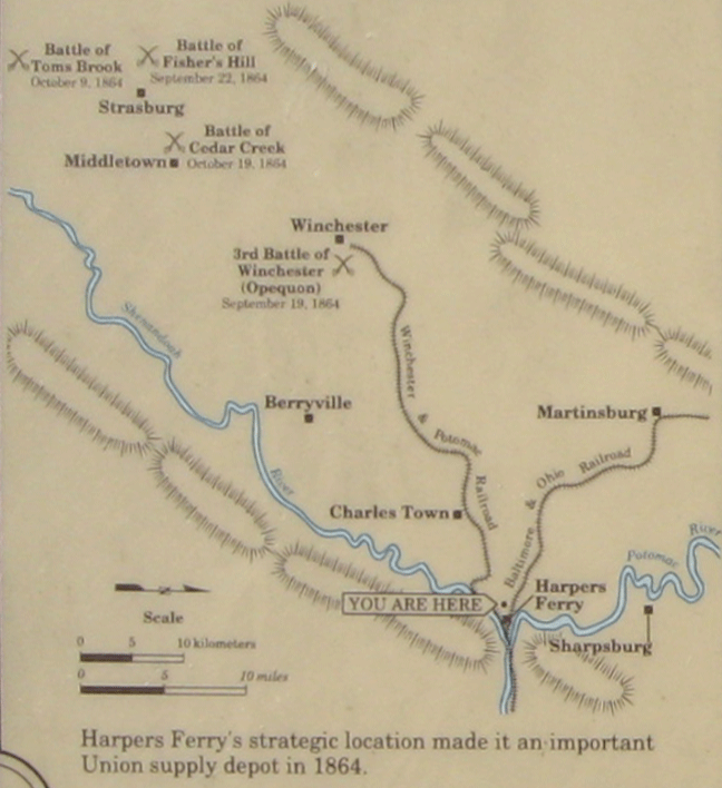
Location of the Protecting the Supply Lines wayside marker
The Protecting the Supply Lines wayside marker is at the southern end of the Redoubt Trail, about 675 yards south of the parking lot.(39°19’25.6″N 77°45’40.4″W) The trailhead is west of Harpers Ferry at the intersection of Whitman Avenue and Prospect Avenue.