
The Struggle to the Heights wayside marker is south of Harpers Ferry on the Murphy Farm Trail in Harpers Ferry National Historic Park. The marker is 200 yards southeast of the Murphy Farm parking area. (39°18’40.3″N 77°45’33.7″W; map) From Shenandoah Street (the road to the Visitor Center) take Campground Road 0.25 mile west, then turn left on Murphy Road for 0.3 mile.
From the marker:
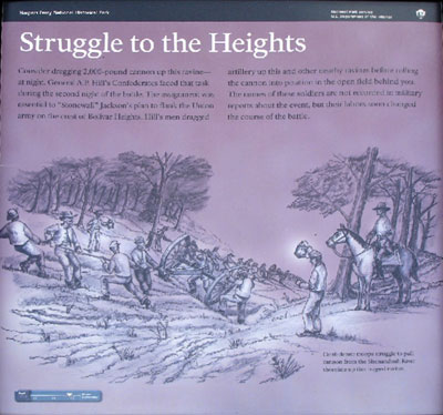
Struggle to the Heights
Consider dragging 2,000-pound cannon up this ravine—at night. General A.P. Hill’s Confederates faced that task during the second night of battle. The assignment was essential to “Stonewall” Jackson’s plan to flank the Union army on the crest of Bolivar Heights. Hill’s men dragged artillery up this and other nearby ravines before rolling the cannon into position in the open field behind you. The names of these soldiers are not recorded in military reports about the event, but their labors soon changed the course of the battle.
From the caption to the background drawing:
Confederate troops struggle to pull cannon from the Shenandoah River shoreline up this rugged ravine.
(go to the main Murphy Farm page)
(go to the main Tour the Harpers Ferry Battlefield page)