
Two markers on the First Battle of Kernstown consisting of text and an accompanying map are at the end of Opequon Church Lane, south of Winchester, Virginia. They were erected by the Virginia Civil War Commission in 1964. The marker are next to the Kernstown Battles marker and the Battle of Kernstown A9 Virginia historical marker.
From the marker:
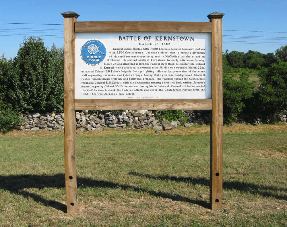
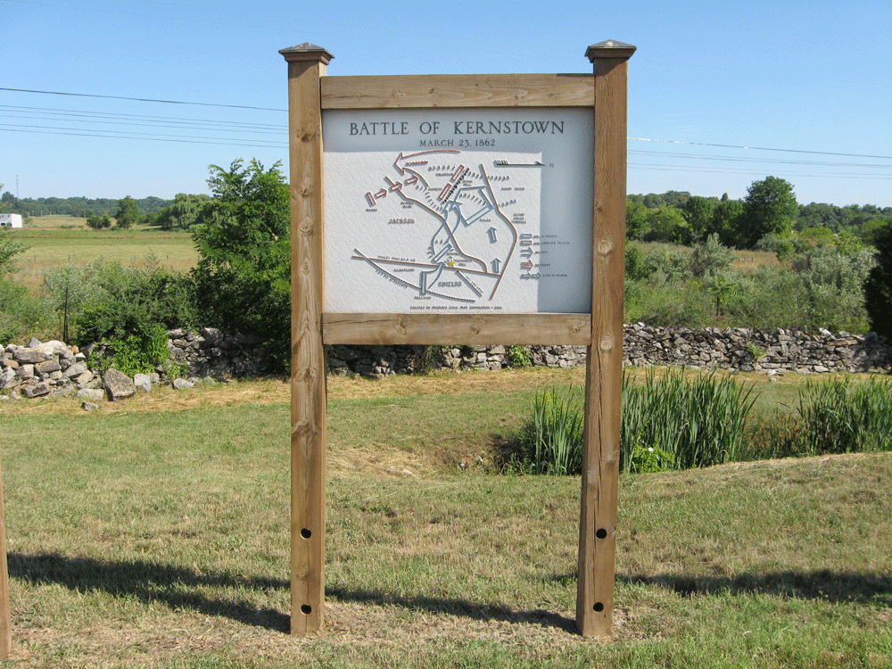
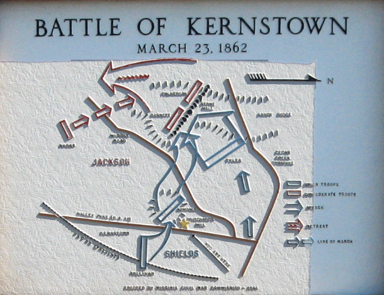
Battle of Kernstown
March 23, 1862
General James Shields with 7,000 Federals defeated Stonewall Jackson with 3,500 Confederates. Jackson’s object was to create a diversion which would prevent troops being sent to McClellan for the attack on Richmond. He arrived south of Kernstown in early afternoon Sunday, March 23, and attempted to turn the Federal right flank. To counter this, Colonel N. Kimball who succeeded to command after Shields was wounded March 22nd, advanced Colonel E.B. Tyler’s brigade. Savage fighting followed for possession of the stone wall separating Jackson’s and Tyler’s troops. Seeing that Tyler was hard-pressed, Kimball rushed reinforcements from his and Sullivan’s brigades. The Federals turned the Confederate right, and General R.B. Garnett with his ammunition running short fell back without Jackson’s orders, exposing Colonel S.V. Fulkerson and forcing his withdrawal. Colonel J.S. Burks reached the field in time to check the Federal attack and cover the Confederate retreat from the field. This was Jackson’s only defeat.
Location
Take the Valley Pike (U.S. 11) south from downtown Winchester or north from Virginia Route 37 (the Winchester bypass) to Opequon Church Lane, which is 150 feet south of Shawnee Drive and 0.4 mile north of Apple Valley Road. Opequon Church Lane heads west 0.2 mile and ends in a turnaround next to the signs, as well as a historic graveyard that holds both Civil War and Revolutionary War veterans. (39°08’24.2″N 78°11’40.6″W)