
Battle of Brandy Station • Tour the Battlefield • Historical & Wayside Markers • The Armies
The Buford’s Knoll Walking Trail crosses land preserved by the Civil War Trust on the Brandy Station battlefield just north of the Culpeper Regional Airport. The trailhead for Buford’s Knoll Walking Trail is on Beverly Ford Road north of the James Madison Highway (U.S. 15 & 29), north of the Culpeper Regional Airport.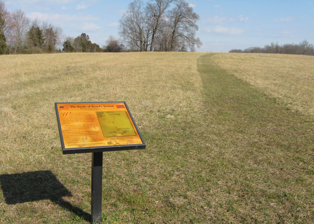
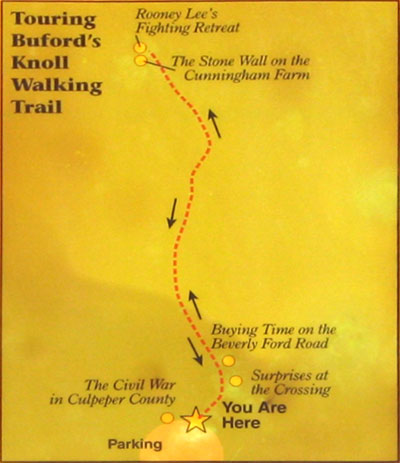
There is a wayside marker at the trailhead and four others along the two-mile trail:
The Civil War in Culpeper County
Surprises at the Crossing
Buying Time on the Beverly Ford Road
The Stone Wall on the Cunningham Farm
Rooney Lee’s Fighting Retreat
A trail marker is at the trailhead next to the parking area:
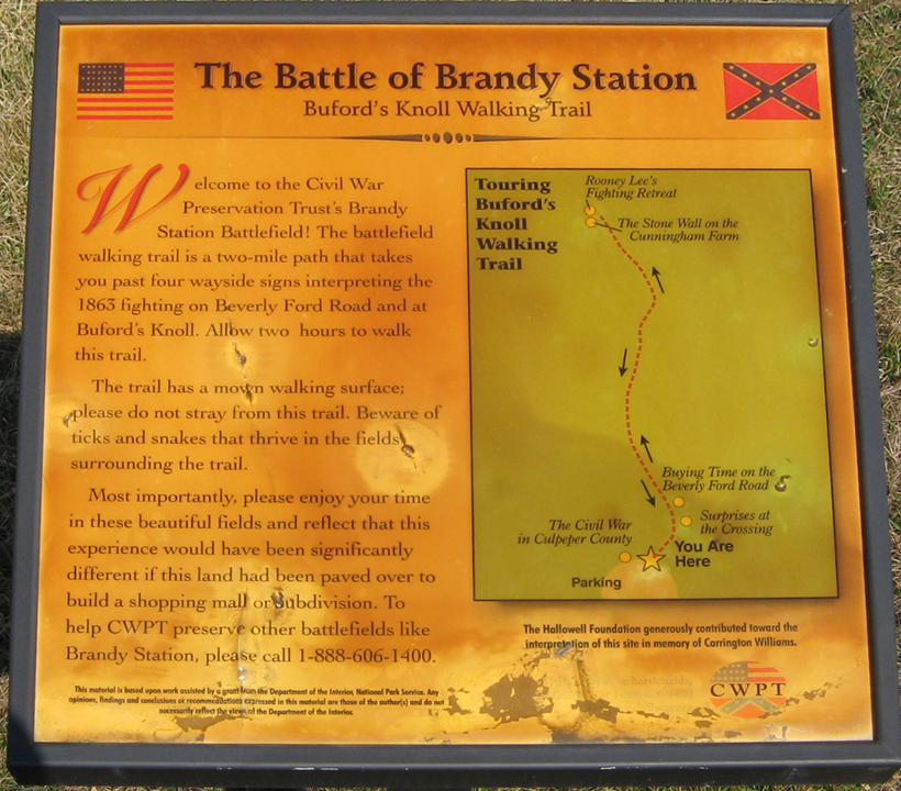
Text from the marker:
Battle of Brandy Station
Buford’s Knoll Walking Trail
Welcome to the Civil War Preservation Trust’s Brandy Station Battlefield! The battlefield walking trail is a two-mile path that takes you past four wayside signs interpreting the 1863 fighting on Beverly Ford Road and at Buford’s Knoll. Allow two hours to walk the trail.
The trail has a mown walking surface; please do not stray from this trail. Beware of ticks and snakes that thrive in the fields surrounding the trail.
Most importantly, please enjoy your time in these beautiful fields and reflect that this experience would have been significantly different if this land had been paved over to build a shopping mall or subdivision. To help CWPT preserve other battlefields like Brandy Station, please call 1-888-606-1400.
This material is based upon work assisted by a grant from the Department of the Interior, National Park Service. Any opinion, findings and conclusions or recommendations expressed in this material are those of the author(s) and do not necessarily reflect the views of the Department of the Interior.
The Hallowell Foundation generously contributed toward the interpretation of this site in memory of Carrington Williams.
Location of the trailhead
The trailhead for Buford’s Knoll Walking Trail is about 1.9 miles north of the James Madison Highway (U.S. 15 & 29) on the west side of Beverly Ford Road, just north of the Culpeper Regional Airport. (38.53247° N, 77.85802° W)