
Battle of Brandy Station • Tour the Battlefield • Historical & Wayside Markers • The Armies
The “Rooney Lee’s Fighting Retreat” wayside marker on is the fourth and final stop on the Buford’s Knoll walking trail. It is next to “The Stone Wall on the Cunningham Farm” wayside marker. It s a little less than a mile due north of the trailhead on Beverly Ford Road.
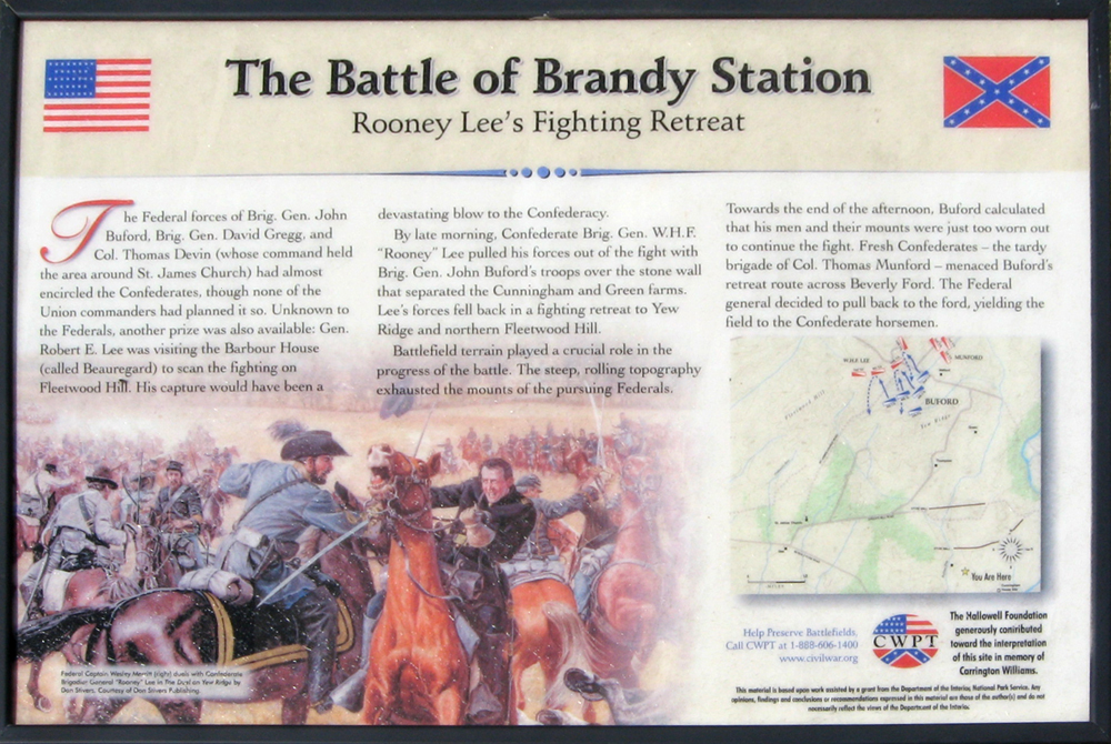
The painting on the marker is “The Duel on Yew Ridge” by Don Stivers, and shows Federal Captain Wesley Merritt (right) dueling with Confederate Brigadier General “Rooney” Lee.

Text from the marker:
The Battle of Brandy Station
Rooney Lee’s Fighting Retreat
The Federal forces of Brig. Gen. John Buford, Brig. Gen. David Gregg, and Col. Thomas Devin (whose command held the area around St. James Church) had almost encircled the Confederates, though none of the Union commanders had planned it so. Unknown to the Federals another prize was also available: Gen. Robert E. Lee was visiting the Barbour House (called Beauregard) to scan the fighting on Fleetwood Hill. His capture would have been a devastating blow to the Confederacy.
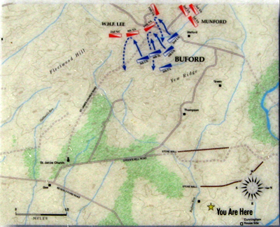
By late morning, Confederate Brig. Gen. W.H.F. “Rooney” Lee pulled his forces out of the fight with Brig. Gen. John Buford’s troops over the stone wall that separated the Cunningham and Green farms. Lee’s forces fell back in a fighting retreat to Yew Ridge and northern Fleetwood Hill.
Battlefield terrain played a crucial role in the progress of the battle. The steep, rolling topography exhausted the mounts of the pursuing Federals. Towards the end of the afternoon, Buford calculated his men and their mounts were just too worn out to continue the fight. Fresh Confederates – the tardy brigade of Col. Thomas Munford – menaced Buford’s retreat route across Beverly Ford. The Federal general decided to pull back to the ford, yielding the field to the Confederate horsemen.
Caption from the painting:
Federal Captain Wesley Merritt (right) duels with Confederate Brigadier General “Rooney” Lee in The Duel on Yew Ridge by Don Stivers, courtesy of Don Stivers Publishing.
Help Preserve Battlefields
Call CWPT at 1-888-606-1400
www.civilwar.org
The Hallowell Foundation generously contributed toward the interpretation of this site in memory of Carrington Williams.
This material is based upon work assisted by a grant from the Department of the Interior, National Park Service. Any opinion, findings and conclusions or recommendations expressed in this material are those of the author(s) and do not necessarily reflect the views of the Department of the Interior.
Buford’s Knoll and wayside markers “The Stone Wall on the Cunningham Farm” and “Rooney Lee’s Fighting Retreat” are on the Buford’s Knoll Walking Trail about one mile north of the trailhead and parking area. (38°32’38.3″N 77°51’32.0″W)