
Battle of Brandy Station • Tour the Battlefield • Historical & Wayside Markers • The Armies
The St. James Church Walking Trail crosses land preserved by the Civil War Trust on the Brandy Station battlefield just west of the Culpeper Regional Airport. The marker and trailhead is on the north side of St. James Church Road across the street from the parkng area at the intersection of St. James Church Road and Beverly Ford Road. There is a trail marker at the beginning of the trail.
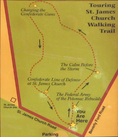
The next stop on the walking tour is “The 1863-64 Winter Encampment – the Federal Army of the Potomac Rebuilds” wayside marker.
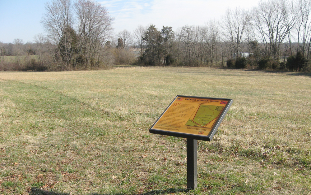
The marker is at the start of the one mile loop walking trail, a mown path through farm fields. Small bridges cross rivulets, but the path can be soggy in spots in damp weather. The fields were the scene of intense cavalry fighting during the Battle of Brandy Station, and although a nearby part of the field has been developed as an airfield, the immedate area is mostly unchanged from 1863.
Five wayside markers are in the parkng area and along the walking trail:
The Largest Cavalry Battle of the Civil War
The Federal Army of the Potomac Rebuilds
The Calm Before the Storm
Charging the Confederate Guns
Confederate Line of Defence at St. James Church
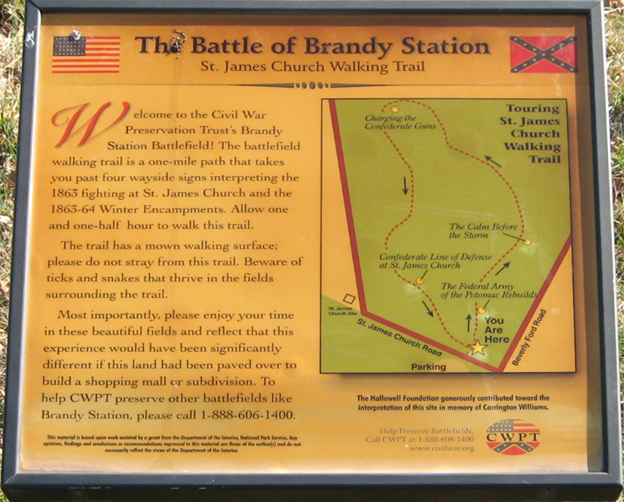
From the trail marker:
The Battle of Brandy Station
St. James Church Walking Trail
Welcome to the Civil War Preservation Trust’s Brandy Station Battlefield! The battlefield walking trail is a one-mile path that takes you past four wayside signs interpreting the 1863 fighting at St. James Church and the 1863-64 Winter Encampments. Allow one and one-half hour to walk this trail.
The trail has a mown walking surface; please do not stray from this trail. Beware of ticks and snakes that thrive in the fields surrounding the trail.
Most importantly, please enjoy your time in these beautiful fields and reflect that this experience would have been significantly different if this land had been paved over to build a shopping mall or subdivision.
To help CWPT preserve other battlefields like Brandy Station, please call 1-888-606-1400.
This material is based upon work assisted by a grant from the Department of the Interior, National Park Service. Any opinion, findings and conclusions or recommendations expressed in this material are those of the author(s) and do not necessarily reflect the views of the Department of the Interior.
The Hallowell Foundation generously contributed toward the interpretation of this site in memory of Carrington Williams.
Location of the marker for the trailhead
The marker is on the north side of St. James Church Road across the street from the parkng area at the intersection of St. James Church Road and Beverly Ford Road, just west of the the Culpeper Regional Airport and about one mile north on Beverly Ford Road from the James Madison Highway (U.S. 15 & 29). (38°31’19.1″N 77°51’56.8″W)