
The Port Republic – Last Battle of Jackson’s 1862 Valley Campaign wayside marker was erected by the Association for the Preservation of Civil War Sites, Inc. at the “Coaling,” the hill that anchored the Union battle line during the Battle of Port Republic.
Another wayside marker about the fight for the Coaling is about 90 yards up the hill behind this marker, and a“Battle of Port Republic” Virginia historical marker is about 75 yards to the north along the main highway.
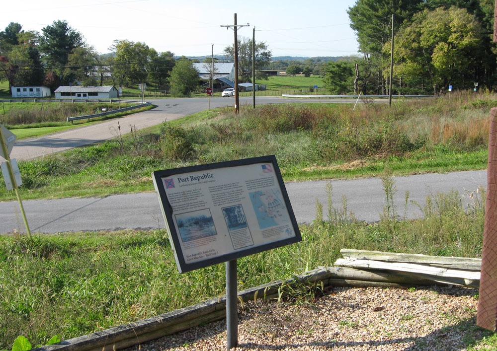
From the marker:
Port Republic
Last Battle of Jackson’s 1862 Valley Campaign
You are standing on the “Coaling.” By the Civil War this area was nearly devoid of trees, the timber having been used for the production of charcoal. This was the key Federal artillery position during the Battle of Port Republic.
Federal commander Brigadier General Erastus Tyler stretched his 3,000 infantry and 3 batteries of artillery in a line from a spur of the Blue Ridge Mountains on your left, along the “Coaling” then ¾ mile to your right, to the South Fork of the Shenandoah River. It would prove a strong position.
On the early morning of June 9, 1862, Confederate Major General Thomas J. “Stonewall” Jackson, victorious the day before at Cross Keys, attacked the Federal line. His leading unit, the famous “Stonewall Brigade,” was easily repulsed two times by a “galling fire of musketry and canister.”
Following this reverse, the Federals on your right counter-attacked, pushing the Confederates back nearly ½ mile. At this point Jackson’s position was precarious. Fortunately for him, Confederate units were now approaching the field.
Port Republic Battlefield Civil War Site—Trail Stop 1
Erected by APCWS – Association for the Preservation of Civil War Sites, Inc.
From the caption to the photo on the left:
This photograph, taken around the turn of the century, shows the ‘Coaling’ before it became overgrown with trees and brush. ‘Mapleton,’ the house in the background, was built in 1886 by Samuel Hance Lewis II and stands behind you.
From the caption to the photo in the center:
The Lewiston House, shown in this photograph taken soon after the war, stood across the road to your right, on the same site where the white hose you see now sits. During the battle, the initial Federal line ran through the Lewiston property all the way to the river, and fighting swirled around the house much of the morning.
From the caption to the map on the right:
Confederate attacks against the Federal right and the ‘Colaing’ failed, and a counter-attack by the United right pushed Jackson’s men back at least ½ mile. Taylor’s Louisiana Brigade came to Jackson’s support and launched the first of its assaults on the “Coaling.”

Location
The marker is 2.5 miles east of Port Republic on the southeast side of the SE Side Highway (U.S. 340) at Ore Bank Road. Turn south onto Ore Bank Road, park in the parking area and cross the street to the Port Republic Battlefield sign.