
The Port Republic – Struggle for the “Coaling” wayside marker was erected by the Association for the Preservation of Civil War Sites, Inc. on the Civil War battlefield of Port Republic, Virginia.
From the marker:
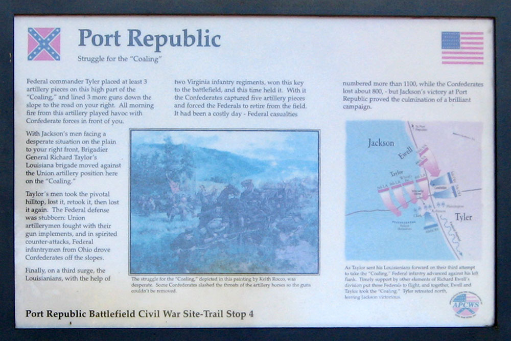
Port Republic
Struggle for the “Coaling”
Federal commander Tyler placed at least 3 artillery pieces on this high part of the “Coaling,” and lined 3 more guns down the slope to the road on your right. All morning fire from this artillery played havoc with Confederate forces in front of you.
With Jackson’s men facing a desperate situation on the plain to your right front, Brigadier General Richard Taylor’s Louisiana brigade moved against the Union artillery position here on the “Coaling.”
Taylor’s men took the pivotal hilltop, lost it, retook it, then lost it again. The Federal defense was stubborn: Union artillerymen fought with their gun implements, and in spirited counter-attacks, Federal infantrymen from Ohio drove Confederates off the slopes.
Finally, on a third surge, the Louisianians, with the help of two Virginia infantry regiments, won this key to the battlefield, and this time held it. With it the Confederates captured five artillery pieces and forced the Federals to retire from the field. It had been a costly day—Federal casualties numbered more than 1100, while the Confederates lost about 800—but Jackson’s victory at Port Republic proved the culmination of a brilliant campaign.
Erected by APCWS – Association for the Preservation of Civil War Sites, Inc.
From the caption to the illustration:
The struggle for the ‘Coaling,’ depicted in this painting by Keith Rocco, was desperate. Some Confederates slashed the throats of the artillery horses so the guns couldn’t be removed.
From the caption for the map:
As Taylor sent his Louisianians forward on their third attempt to take the ‘Coaling,’ Federal infantry advanced against his left flank. Timely support by other elements of Richard Ewell’s division put these Federals to flight, and together, Ewell and Taylor took the ‘Coaling.’ Tyler retreated north, leaving Jackson victorious.

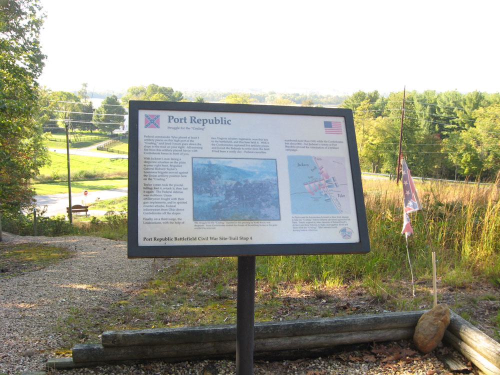
The view is to the northwest from in front of the position of the wayside marker near the top of the “Coaling.” The S.E. Side Highway (left to rght) and Ore Bank Road intersect in the distance. Ore Bank Road paralleled the line of battle from this hill to the river about 3/4 mile to the west (upper right in the photo.)
Location
The marker is 2.5 miles east of Port Republic on the southeast side of the SE Side Highway (U.S. 340) at Ore Bank Road. Turn south onto Ore Bank Road, park in the parking area and cross the street to the Port Republic Battlefield sign. (This is the location of the “Last Battle of Jackson’s 1862 Valley Campaign” wayside marker.) Continue uphill about 270 feet on the foot path.