
Strasburg > Hupp’s Hill Civil War/Karst interpretive walking trail
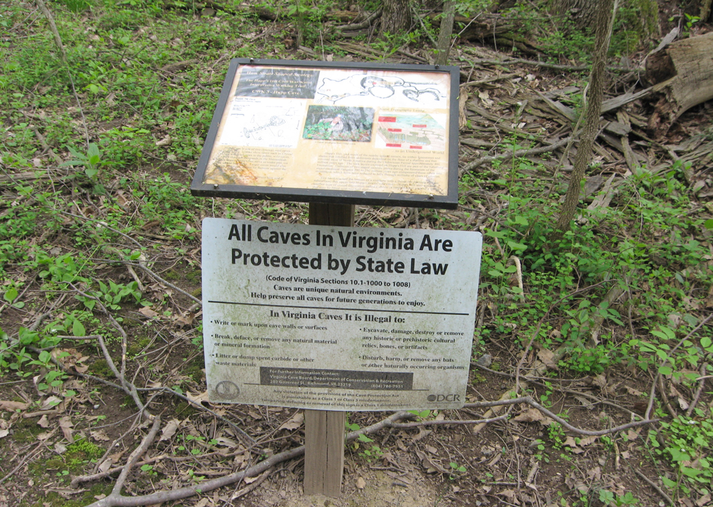
The Hupp Cave trail marker CWK-3 is one of several along the walking trail at the Hupp’s Hill Civil War Park north of Strasburg, Virginia.
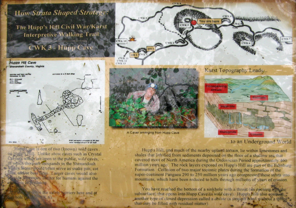
From the marker:
How Strata Shaped Strategy:
The Hupp’s Hill Civil War/Karst
Interpretive Walking Trail
Hupp Cave CWK-3
Hupp Cave is one of two (known) wild caves on Hupp’s Hill. Unlike show caves such as crystal Ceverns which are open to the public, wild caves, of which there are thousands in the Shenandoah Valley, would often serve as snake pits, cat lairs, and/or bear pens. Larger caves would also provide temporary shelter for humans against the elements or predators.
Please observe the safety barriers here and at Keyhole Cave (CVK6).
Karst Topography Leads…
…to an Underground World
Hupp’s Hill, and much of the nearby upland terrain, lie within limestones and shales that lithified from sediments deposited on the floor of a shallow sea that covered most of North America during the Ordovician Period approximately 460 million years ago. The rock layers exposed on Hupp’s Hill are part of the Edinburg Formation. Collision of two major tectonic plates during the formation of the super-continent Pangea 290 to 250 million years ago compressed these strata into mountains, which have been reduced to hills through millions of years of erosion.
You have reached the bottom of a sinkhole with a throat (an opening with the subsurface) that opens into Hupp Cave (a wild cave). Hupp’s Hill also contains another type of closed depression called a doline (a smooth bowl without a throat that mat be filled with residual matter).
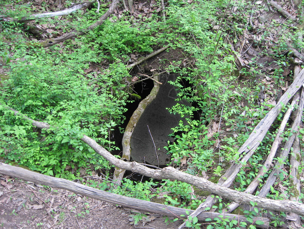
The mouth of Hupp Cave