
Battles of Manassas • Tour the Battlefield • Monuments • The Armies
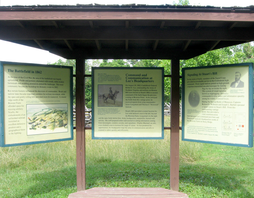
The Stuart’s Hill Exhibit Kiosk is at the Stuart’s Hill Center on the southwest side of the battlefield (see map below).
Text from the left panel:
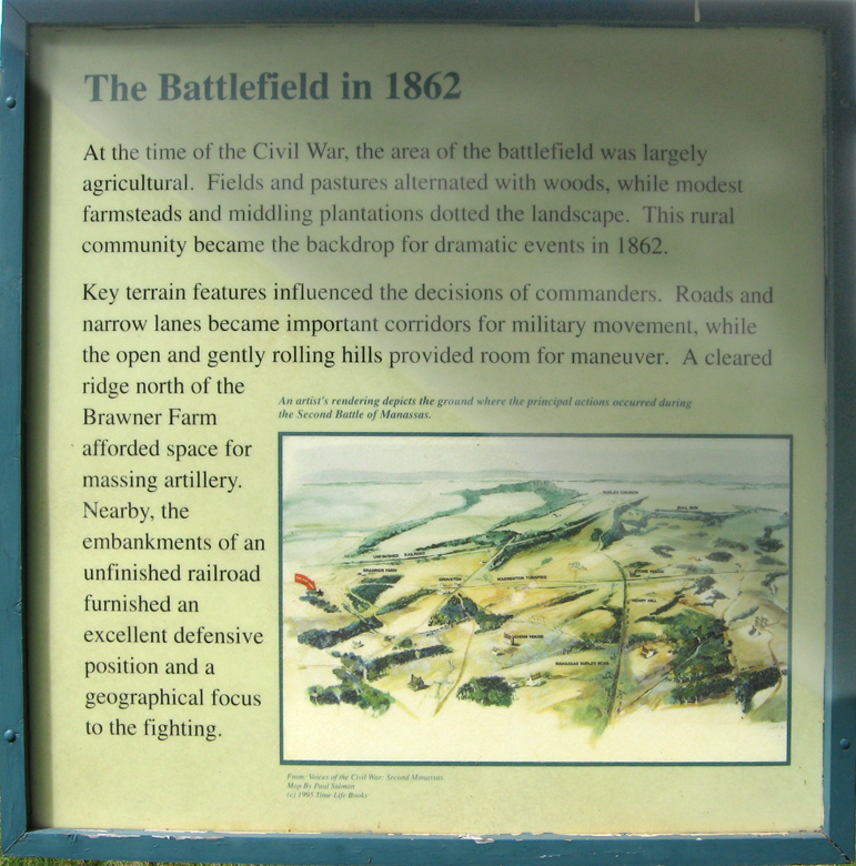
The Battlefield in 1862
At the time of the Civil War, the area of the battlefield was largely agricultural. Fields and pastures alternated with woods, while modest farmsteads and middling plantations dotted the landscape. This rural community became the backdrop for dramatic events in 1862.
Key terrain features influenced the decisions of commanders. Roads and narrow lanes became important corridors for military movement, while the open and gently rolling hill provided room for maneuver. A cleared ridge north of the Brawner Farm afforded space for massing artillery, Nearby, the embankments of an unfitted railroad furnished an excellent defensive position and a geographical focus for the fighting.
Caption to the drawing:
An artist’s rendering depicts the ground where the principal actions occurred during the Secnd Battle of Manassas.
Text from the center panel:
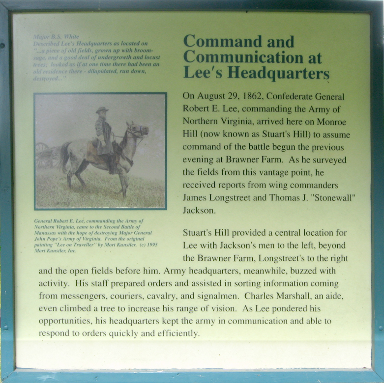
Major B.S. White
Described Lee’s headquarters as located on “a piece of old fields, grown up with broom sage, and a good deal of undergrowth and locust trees; looked as if at one time there had been an old residence there – dilapidated, run down, destroyed…”
Command and Communication at Lee’s Headquarters
On August 29, 1862, Confederate General Robert E. Lee, commanding the Army of Northern Virginia, arrived here on Monroe Hill (now known as Stuart’s Hill) to assume command of the battle begun the previous evening at Brawner Farm. As he surveyed the field from this vantage point, he received reports from wing commanders James Longstreet and Thomas J. “Stonewall” Jackson.
Stuart’s Hill provided a central location for Lee, with Jackson’s men to the left beyond the Brawner Farm, Longstreet’s to the right and the open fields before him. Army headquarters, meanwhile, buzzed with activity. His staff prepared orders and assisted in sorting information coming from messengers, couriers, cavalry, and signalmen. Charles Marshall, an aide, even climbed a tree to increase his range of vision. As Lee pondered his opportunities, his headquarters kept the army in communication and able to respond to orders quickly and efficiently.
Caption to the photograph on the left:
General Robert E. Lee, commanding the a Army of Northern Virginia, came to the Second Battle of Manassas with the hope of destroying Major General John Pope’s Army of Virginia. From the original painting “Lee on Traveller” by mort Kunstler ©1995 Mort Kunstler, Inc.
Text from the right panel:
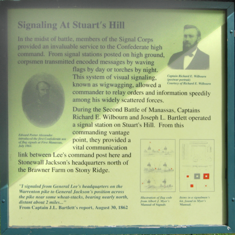
Signaling at Stuart’s Hill
In the midst of the battle, members of the Signal Corps provided an invaluable service to the Confederate high command. From signal stations posted on high ground, corpsmen transmitted encoded messages by waving flags by day or torches by night. The system of visual signaling, known as wigwagging, allowed a commander to relay orders and information speedily among his widely scattered forces.
During the Second Battle of Manassas, Captains Richard E. Wilbourn and Joseph L. Bartlett operated a signal station on Stuart’s Hill. From this commanding vantage point, they provided a vital communications link between Lee’s command post here and Stonewall Jackson’s headquarters north of the Brawner Farm on Stony Ridge.
“I signaled from General Lee’s headquarters on the Warrenton Pike to General Jackson’s position across the pike near some wheat-stacks, bearing nearly north, distant about 2 miles.”
From Captain J. L. Bartlett’s report, August 30, 1862
Caption to the portrait on the upper right:
Captain Richard E. Wilbourn
(postwar portrait)
Courtesy of Richard E. Wilbourn
Caption to the photo on the left side:
Edward Porter Alexander introduced the first confederate set of flag signals at First Manassas, July 1861
Captions on the lower right:
Illustration of flag code from Albert J. Meyer’s Manual of Signals.
Items in a signalman’s kit. foud in Meyer’s manual.
Location of the Stuart’s Hill Exhibit Kiosk
The kiosk is about 120 feet east of the parking area at the Stuart’s Hill Center, located just south of Lee Highway, US 29 off Pageland Lane.