
Battle of Spotsylvania • Tour the Battlefield • Monuments & Markers • The Armies
The Laurel Hill Trail starts at the entrance to the Spotsylvania Court House battlefield. (see map below) It is not a stop on the auto tour but is only about 100 yards south of the parking area for Stop One.

Several markers and monuments are along the one mile Laurel Hill Trail (listed in order as you follow the trail):
Warren’s Line wayside marker
Spindle House wayside marker
Maryland Brigade monument
Fight for the Fences wayside marker
The Monument to Major General John Sedgwick (see more) is at the trailhead.
The Spotsylvania Campaign May 8-10 marker (see more) is on the east side of Grant Road, across from the Sedgwick monument
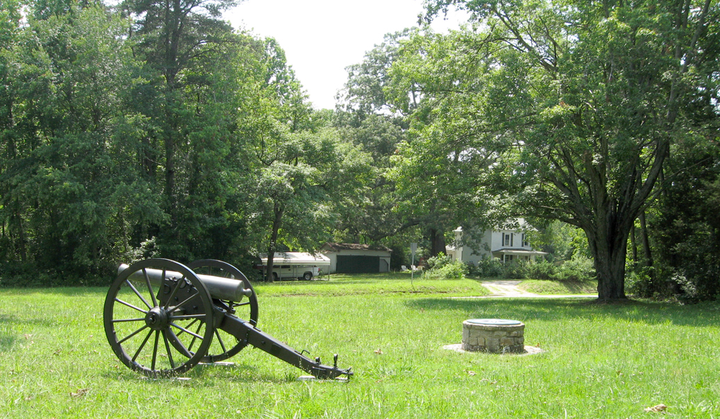
The Laurel Hill Trailhead Marker, two wayside markers and the Spotsylvania Compass Rose are here at the trailhead (see below):
Laurel Hill trailhead marker

Text from the marker:
Laurel Hill Trail
Although not as famous as the “Bloody Angle,” the fighting at Laurel Hill played an important Role in the Battle of Spotsylvania Court House. Here the battle begam, and here more than 5,000 soldiers suffered or died. The Laurel Hill Trail leads to some key sites in the struggle. The trail begins across the road. Be careful in crossing – traffic here can be heavy and sight distance limited.
Trail length: One Mile
Difficulty: moderate
Time: One Hour
Laurel Hill Wayside Marker

Text from the marker:
Laurel Hill
[The] Federal assaults were not only easily repulsed, but the forces making them were simply slaughtered.
Private John Coxe,
2nd South Carolina Infantry
Before you lies Laurel Hill, one of the most important but least understood areas of the Spotsylvania Court House battlefield. On three separate days—May 8, 10, and 12—Union troops charged across these fields, from right to left, in an effort to break the Confederate army’s hold on the wooded ridge to your left. Each attack ended in bloody failure.
With each repulse, the Union soldiers’ enthusiasm for attacking the ridge diminished. “Every man in the ranks saw the folly of the attempt,” wrote a soldier in the 83rd Pennsylvania Volunteers, “and judging from the undercurrent of their conversation, it is not probable that they would have made a very determined effort, or gone far.”
In all, some 5,000 Union soldiers fell here—all to no purpose. On May 13, the Union army abandoned Laurel Hill and headed east. The Confederates followed.
Caption for the background image:
Union troops at Laurel Hill.
The Race for Spotsylvania Court House wayside marker
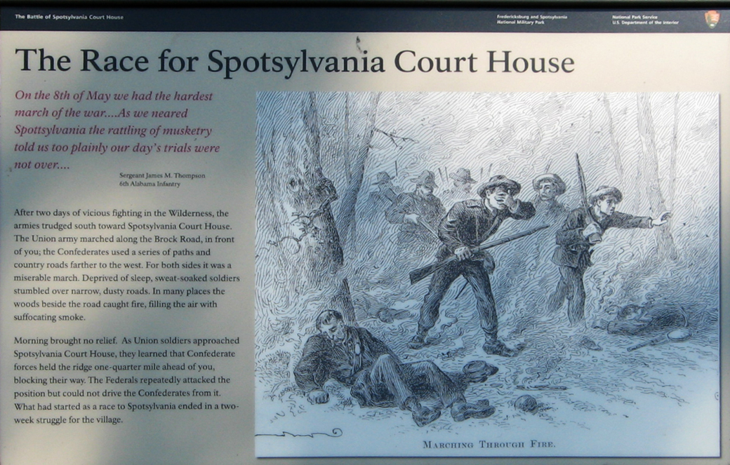
Text from the marker:
The Race for Spotsylvania Court House
On the 8th of May we had the hardest march of the war….as we neared Spottsylvania the rattling of musketry told us too plainly our day’s trials were not over….
Sergeant James M. Thompson
6th Alabama Infantry
After two days of vicious fighting in the Wilderness, the armies trudged south toward Spotsylvania Court House. The Union army marched along the Brock Road, in front of you; the Confederates used a series of paths and country roads farther to the west. For both sides it was a miserable march. Deprived of sleep, sweat-soaked soldiers stumbled over narrow, dusty roads. In many places the woods beside the road caught fire, filling the air with suffocating smoke.
Morning brought no relief. As Union soldiers approached Spotsylvania Court House, they learned that Confederate forces held the ridge one-quarter mile ahead of you, blocking their way. The Federals repeatedly attacked the position but could not drive the Confederates from it. What had started as a race to Spotsylvania ended in a two-week struggle for the village.
Caption to the drawing:
Marching through fire.
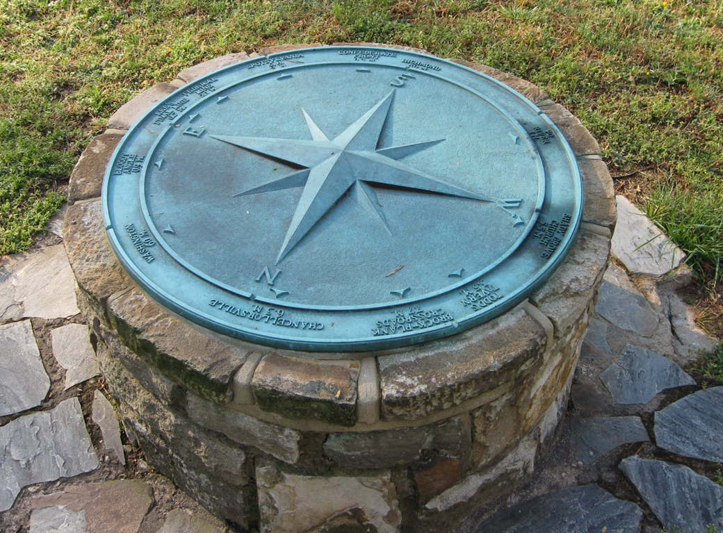
Spotsylvania Compass Rose
The Spotsylvania Compass Rose is one of several placed on battlefields in Fredericksburg and in Spotsylvania County, and one of two on the Spotsylvania Battlefield. (There is also a compass rose on Brock Road on the Wilderness battlefield.) The monuments consist of a large bronze compass set onto a masonry foundation.
The Compass Rose shows distances and directions in miles to several locations important to the battle or in the Civil War. Staring from the north and moving clockwise:
N
Washington 60 m
Bloody Angle 0.9 m
E
Lee’s Final Line 0.7 m
Federal Line 2.1 m
Spotsylvania C.H. 2 m
Confederate front 0.3 m
S
Richmond 50 m
Po River 1 m
W
Shady Grove Church 5.5 m
Todd’s Tavern 3.5 m
Brock-Plank Crossroads 7.7 m*
Chancellorsville 6.3 m
Location of the Laurel Hill Trailhead
The Laurel Hill Trail starts at the entrance to the Spotsylvania Court House battlefield at the intersection of Brock Road, Grand Road and Hancock Drive. (38°13’04.4″N 77°36’52.5″W) It is about 100 yards south of the parking area for Stop One of the Spotsylvania Battlefield Auto Tour.
(return to the main Stop 1 page)
(return to the main Battle of Spotsylvania Auto Tour page)