
Battle of Monocacy • Tour the Battlefield • Monuments & Markers • Armies
“The Battle That Saved Washington” wayside marker is at a scenic overlook on the westbound lanes of Interstate 270 expressway about 2.5 miles north of the Maryland Route 80 exit for Urbana. (see map below) The “Clustered Spires of Frederick” wayside marker is nearby.
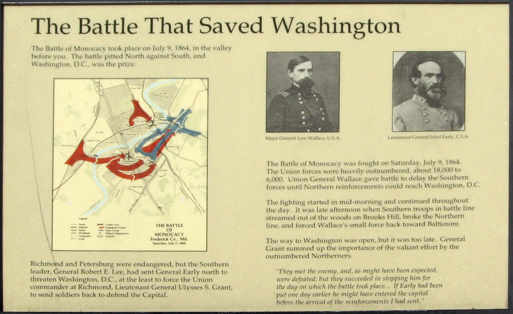
Text from the marker:
The Battle That Saved Washington
The Battle of Monocacy took place on July 9, 1864, in the valley before you. The battle pitted North against South, and Washington, D.C., was the prize.
Richmond and Petersburg were endangered, but the Southern leader, General Robert E. Lee had sent General Early north to threaten Washington, D.C., at least to force the Union commander at Richmond, Lieutenant General Ulysses S. Grant, to send soldiers back to defend the Capital.
The Battle of Monocacy was fought on Saturday, July 9, 1864. The Union forces were heavily outnumbered, about 18,000 to 6,000. Union General Lew Wallace gave battle to delay the Southern forces until Northern reinforcements could reach Washington, D.C.
The fighting started in mid-morning and continued throughout the day. In the late afternoon when Southern troops in battle line streamed out of the woods on Brooks Hill, broke the Northern lines and forced Wallace’s small force back towards Baltimore.
The way to Washington was open, but it was too late. General Grant summed up the importance of the valiant effort by outnumbered Northerners.
“They met the enemy, and, as might have been expected, were defeated; but they succeeded in stopping him for the day on which the battle took place… If Early had been but one day earlier he might have entered the capital before the arrival of the reinforcements I had sent.”
Caption to the map:
Richmond and Petersburg were endangered, but the Southern leader, General Robert E. Lee, had sent General Early north to threaten Washington, D.C., at the least to force the Union commander at Richmond, Lieutenant General Ulysses S. Grant, to send soldiers back to defend the Capital.
Location
The scenic overlook is on the westbound lanes of Interstate 270 about 2.5 miles north of the Maryland Route 80 exit for Urbana. The wayside markers for the Battle That Saved Washington and Clustered Spires of Frederick are near the center of the parking area of the overlook. (39°20’58.4″N 77°23’23.7″W)
Note that to reach these markers from the park you would need to head south 4 miles on Urbana Pike (Maryland 355), turn west on Maryland Route 80, then get on Interstate 270 heading north.