
Battle of Monocacy • Tour the Battlefield • Monuments & Markers • Armies
The “Confederates Invade Maryland” wayside marker is on the Monocacy battlefield north of the John Best farmhouse. (see map below) It is next to the Best Family Farm wayside marker.
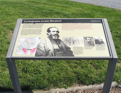
Text from the marker:
Confederates Invade Maryland
7:00 a.m, July 9, 1864
Confederate troops under Lt. Gen. Jubal A. Early streamed through the gaps of South Mountain and the Catoctins and headed south past Frederick. Bound for Washington, D.C., they were stopped here at the Best family farm by Union troops defending the bridges over the Monocacy River.
General Early decided a head-on attack would be too costly and spread his men across these farmlands. While Maj. Gen. Stephen D. Ramseur pinned down the Union center, Early sent Brig. Gen. John McCausland and Maj. Gen. John C. Breckinridge around to the southwest, hoping to find a place to ford the river and attack the Union’s left flank.
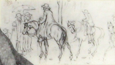
The men took off blankets, oilcloths, etc., and stretched them in fence corners, on muskets and rails, to make a shelter from the sun…in the road and on a hill which overlooked the battle that was about to be fought in our front.
1st Sgt. John H. Worsham, 21st Virgina.

Inset photos and captions from the marker:
On the morning of July 9, Jubal Early, demanded a $200,000 ransom from the citizens of Frederick. Previously, on July 6, as they were leaving the Shenandoah Valley, Early ordered Brig. Gen. John McCausland to exact a $200,000 ransom from Hagerstown. By mistake he obtained only $20,000, plus some clothing.
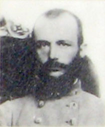
John Breckinridge had served as vice president in James Buchanan’s administration, 1857-61.
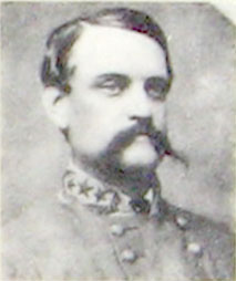
Fearless Stephen Ramseur, 27 years old was a staunch advocate of slavery. He resigned from the Union army even before his state, North Carolina, seceded.
Location of the marker
The “Confederates Invade Maryland” wayside marker is on the Monocacy battlefield on the west side of the Urbana Pike (Maryland Route 355) 2 miles south of Interstate 70 and 0.3 mile south of the Visitor Center drive. The marker is next to the parking area north of the John Best farmhouse. (39°22’14.0″N 77°23’55.3″W)