
Battles of Manassas • Tour the Battlefield • Monuments • Facts • The Armies
Three Virginia Historical markers were moved a short distance from a position along Lee highway. They are no at the edge of the Stone House parking area. The photos show them in their original location.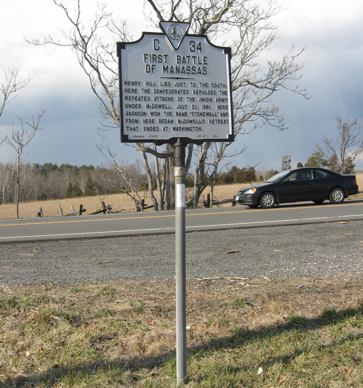
Text from the historical marker:
C34
First Battle
of Manassas
Henry Hill lies just to the south.
Here the Confederates repulsed the
repeated attacks of the Union army
under McDowell. July 21, 1861. Here
Jackson won the name “Stonewall” and
from here began McDowell’s retreat
that ended at Washington.
Virginia State Library 1961

Text from the historical marker:
C44
First Battle
of Manassas
On the Matthews Hill, just to the north,
the Confederates repulsed the attack
of the Unionists, coming from the
north, in the forenoon of July 21, 1861.
The Union forces, reinforced, drove the
Confederates to the Henry Hill, just to
the south. There the latter reformed
under cover of Stonewall Jackson.
In the afternoon, McDowell vainly at-
tempted to rally his retreating troops
on the Matthews Hill after they
had been driven down the Henry Hill.
Conservation and Development Commission 1931
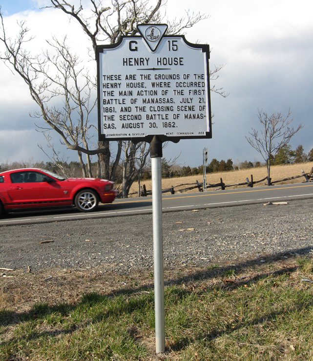
From the historical marker:
G15
Henry House
These are the grounds of the
Henry House, where occurred
the main action of the First
Battle of Manassas, July 21,
1861, and the closing scene of
the Second Battle of Manassas,
August 30, 1862.
Conservation and Development Commission 1935

The three markers were moved from about a thousand feet to the east along the south side of Lee Highway. A fourth marker, for the Robinson House, remains there.
Location of the markers
The wayside markers are 0n the east side of the Stone House parking area, which is on the northeast side of the intersection of US 29 with Sudley Road, Virginia Route 234. (38°49’09.6″N 77°31’29.1″W)