
Harpers Ferry Main • Tour the Battlefield > Bolivar Heights • Timeline
The ridge to the west of Harpers Ferry known as Bolivar Heights was the backbone of the Union position in September of 1862. Union commander Colonel Dixon S. Miles positioned over half his garrison there. But the two other ridges surrounding Harpers Ferry, Maryland Heights and Loudoun Heights, were considerably higher. They were seized by Confederate forces at the same time Bolivar Heights was threatened from the west and south. The Union position at Harpers Ferry was doomed.
There is a parking area at the corner of Whitman Avenue and Prospect Avenue. It serves as the trailhead for a loop trail along Bolivar Heights, with an extension, the Redoubt Trail, that extends 370 yards south. A trail also heads down from the parking area to the Union Skirmish line trail and the North Schoolhouse Ridge Trail.
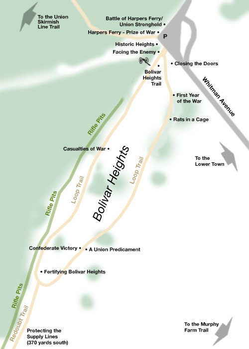
Wayside markers on Bolivar Heights:
A Union Predicament
Battle of Harpers Ferry/Union Stronghold
Bolivar Heights Trail
Casualties of War
Confederate Victory
Closing the Doors
Facing the Enemy
First Year of the War
Fortifying Bolivar Heights
Harpers Ferry – Prize of War
Historic Heights
Protecting the Supply Lines
Rats in a Cage