
The Area History marker is on private property in the Harpers Ferry KOA campground. The campground is on Campground Road, which runs west from Shenandoah Road (the road to the National Park Visitor Center). The markers are along the driveways in the campground. (39°18’57.0″N 77°45’45.7″W; map)
From the marker:
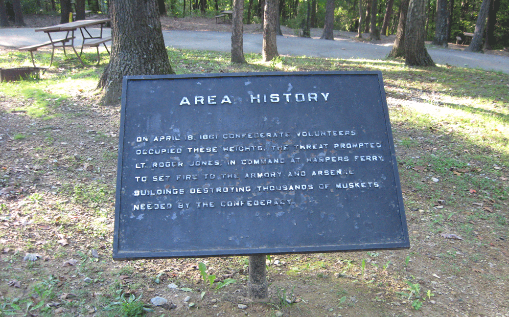
Area History
On April 18, 1861 Confederate volunteers occupied these heights. The threat prompted Lt. Roger Jones, in command at Harpers Ferry, to set fire to the armory and arsenal buildings destroying thousands of muskets needed by the Confederacy.
(go to the main Union Skimish Line page)
(go to the main KOA Campground page)