
Harpers Ferry Main • Tour the Battlefield > Lower Town • Timeline
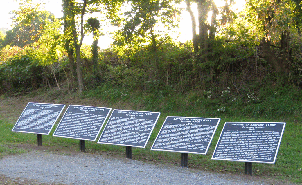
Five iron markers telling the story of the September 1862 Capture of Harpers Ferry were erected in 1897 in the Lower Town of Harpers Ferry. The tablets were created by the Antietam Battlefield Board under the authority of the War Department as part of a set of 217 tablets on the Antietam battlefield and 25 others at locations important to the battle of Antietam.
Text from the markers:
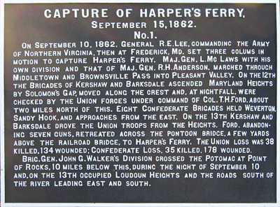
Capture of Harper’s Ferry
September 15, 1862
No. 1
On September 10, 1862 General R. E. Lee Commanding the Army of Northern Virginia then at Frederick Md. set three columns in motion to capture Harper’s Ferry. Maj. Gen L. McLaws with his own Division and that of Maj. Gen. R. H. Anderson, marched through Middletown and Brownsville Pass into Pleasant Valley. On the 12th, the Brigades of Kershaw and Barksdale ascended Maryland Heights by Solomon’s Gap, moved along the crest and, at nightfall were checked by the Union forces under command of Col. T. H. Ford, about two miles north of this. Eight Confederate Brigades held Weaverton, Sandy Hook and approaches from the east. On the 13th, Kershaw and Barksdale drove the Union Troops from the Heights. Ford, abandoning seven guns, retreated across the pontoon bridge, a few yards above the railroad bridge, to Harpers Ferry. The Union loss was 38 killed, 134 wounded; Confederate loss 35 killed, 178 wounded.
Brig. Gen. John G. Walker’s Division crossed the Potomac at Point of Rocks, 10 miles below this during the night of September 10, and, on the 13th occupied Loudoun Heights and the roads south of the river leading east and south.
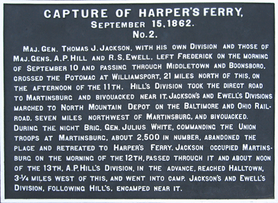
No. 2
Maj. Gen. Thomas J. Jackson, with his own Division and those of Maj. Gen. A. P. Hill and R. S. Ewell, left Frederick on the morning of September 10 and passing through Middletown and Boonsboro crossed the Potomac at Williamsport, 21 miles north of this. On the afternoon of the 11th, Hill’s Division took the direct road to Martinsburg and bivouacked near it. Jackson’s and Ewell’s Divisions marched to North Mountain Depot on the Baltimore and Ohio Railroad seven miles Northeast of Martinsburg, and bivouacked. During the night Brig. Gen. Julius White, Commanding the Union Troops at Martinsburg, about 2,500 in number abandoned the place and retreated to Harpers Ferry. Jackson occupied Martinsburg on the morning of the 12th, passed through it and about noon of the 13th A. P. Hill’s Division, in the advance, reached Halltown, 3¾ miles West of this and went into camp. Jackson’s and Ewell’s Division following Hill’s, encamped near it.
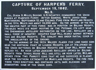
No. 3
Col. Dixon S. Miles, Second U. S. Infantry, commanded the Union forces at Harpers Ferry. After Gen. White joined from Martinsburg, September 12 and Col. Ford from Maryland Heights on the 13th, Miles had about 14,200 men. On the morning of the 14th, the greater part of this force was in position on Bolivar Heights 15/8 miles west, its right resting on the Potomac, its left near the Shenandoah; Artillery distributed on the line. Artillery and a small force of Infantry occupied Camp Hill, nearly midway between this and Bolivar Heights. The Cavalry was under partial cover of the irregularities of the ground.
On the morning of the 14th Walker placed five long range guns near the northern part of Loudon Heights, and, at 1 P.M., opened on the Union Batteries on Bolivar Heights and Camp Hill, which was replied to. An hour later Jackson’s Artillery opened on Bolivar Heights from School House Hill and, still an hour later, McLaws opened from two Parrott Guns that he had succeeded in placing near the southern extremity of Maryland Heights. The fire from these three Divisions was continued until dark silencing and dismounting some of the Union Guns.
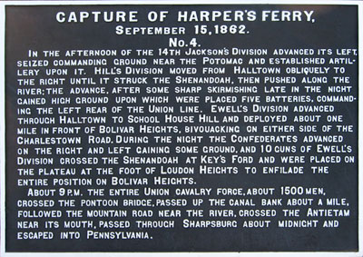
No. 4
In the afternoon of the 14th Jackson’s Division advanced its left, seized commanding ground near the Potomac and established Artillery upon it. Hill’s Division moved from Halltown obliquely to the right until it struck the Shenandoah, then pushed along the river; the advance, after some sharp skirmishing late in the night gained high ground upon which were placed five Batteries. Commanding the left rear of the Union line. Ewell’s Division advanced through Halltown to School House Hill and deployed about one mile on front of Bolivar Heights, bivouacking on either side of the Charlestown Road. During the night the Confederates advanced on the right and left gaining some ground, and 10 guns of Ewell’s Division crossed the Shenandoah at Key’s Ford and were placed on the plateau at the foot of Loudon Heights to enfilade the entire Position on Bolivar Heights.
About 9 P.M. the entire Union Cavalry force, about 1500 men, crossed the Pontoon Bridge, passed up the canal bank about a mile followed the mountain road near the river, crossed the Antietam near its mouth, passed through Sharpsburg about midnight and escaped into Pennsylvania.
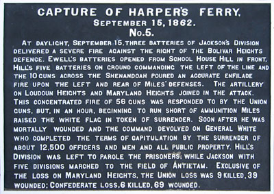
No. 5
At daylight, September 15, three Batteries of Jackson’s Division delivered a severe fire against the right of the Bolivar Heights defense. Ewell’s Batteries opened from School House Hill in front. Hill’s five Batteries on ground commanding the left of the line and the 10 guns across the Shenandoah poured an accurate enfilade fire upon the left and rear of Miles’ defenses. The Artillery on Loudoun Heights and Maryland Heights, joined the attack. This concentrated fire of 58 guns was responded to by the Union guns but, in an hour, beginning to run short of ammunition Miles raised the white flag in token of surrender. Soon after he was mortally wounded and the command devolved on General White who completed the terms of capitulation by the surrender of about 12,500 Officers and men and all public property. Hill’s Division was left to parole the prisoners, while Jackson with five Divisions marched to the field of Antietam. Exclusive of the loss on Maryland Heights, the Union loss was 9 killed, 39 wounded; Confederate loss 6 killed, 69 wounded.
Location of the markers
The set of five War Department markers are in the Lower Town of Harpers Ferry at the confluence of the Shenandoah and Potomac Rivers, 70 yards east of the intersection of Potomac and Shenandoah Streets and just east of the railroad embankment and underpass. (39°19’22.6″N 77°43’44.6″W)