
Battle of Monocacy • Tour the Battlefield • Monuments & Markers • Facts
The Burning of the Bridges wayside marker is along the bank of the Monocacy river on a walking trail from the Gambrill Mill parking area, (see map below) The modern Urbana Pike truss bridge visible from the marker crosses the river near the site of the Civil War covered bridge. The ‘Fleeing for Their Lives’ wayside marker is a few feet away.

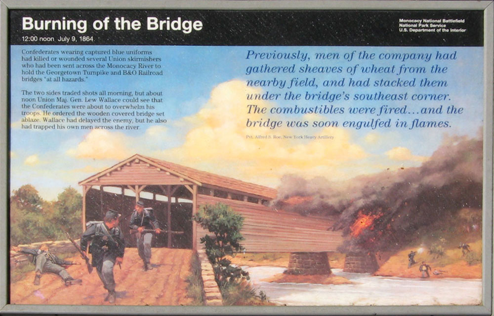
From the marker:
Burning of the Bridge
12:00 noon July 9, 1864
Confederates wearing captured blue uniforms had killed or wounded several Union skirmishers who had been sent across the Monocacy River to hold the Georgetown Turnpike and B&O Railroad bridges “at all hazards.”
The two sides traded shots all morning, but about noon Union Maj. Gen. Lew Wallace could see that the Confederates were about to overwhelm his troops. He ordered the wooden covered bridge set ablaze. Wallace had delayed the enemy, but he also had trapped his own men across the river.
Previously, men of the company had gathered sheaves of wheat from the nearby field, and had stacked them under the bridge’s southeast corner. The combustibles were fired …and the bridge was soon engulfed in flames.
Pvt. Alfred S. Roe, New York Heavy Artillery
Location
The Fleeing for Their Lives and Burning of the Bridge markers are about 275 yards along a walking path whose trailhead is in the Gambrill Mill parking area. Gambrill Mill is located just off the Urbana Pike (Maryland Route 355) opposite Araby Church Road, about 0.9 mile south of the National Park Visitor Center.