
Cedar Creek • Tour the Battlefield • Battle Maps • Battle Facts • The Armies
The marker showing the end of Union Major General Philip Sheridan’s famous ride from Winchester is on the northwest side of the Valley Pike (U.S. 11) at Rienzi Knoll Lane. (39°02’48.1″N 78°15’32.2″W; see map below) It was erected in 1927 by the Virginia Conservation & Development Commission.
At the time of the Battle of Cedar Creek Sheridan was returning to his Army of the Shenandoah after a conference with the Union high command. He had stayed the night at his headquarters in Winchester but when he suspected a battle might be in progress he swiftly rode his powerful horse, Rienzi, from Winchester to this spot, rallying his troops as he came. The Union forces reorganized and launched a devastating counterattack which eliminated Confederate General Jubal Early’s army in the Shenandoah Valley.
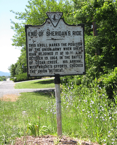
From the marker:
End of Sheridan’s Ride
This knoll marks the position
of the Union Army when Sher-
idan rejoined it at 10.30 a.m.
October 19, 1864 in the Battle
of Cedar Creek. His arrival
with Wright’s efforts checked
the Union retreat.
The historical marker is on the northwest side of the Valley Pike (US 11) northeast of Middletown, Virginia.